First Alert Weather: Tracking some warm weather ahead with a very changeable Wednesday on the way

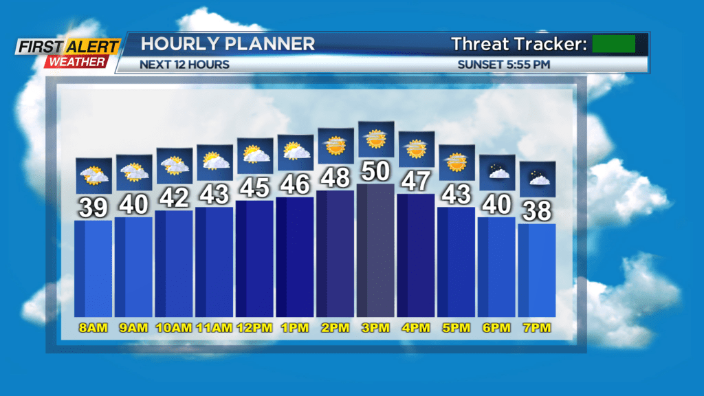
ROCHESTER, N.Y. — A beautiful start to the week with mostly sunny skies and temps warming nicely to near 50 Monday.
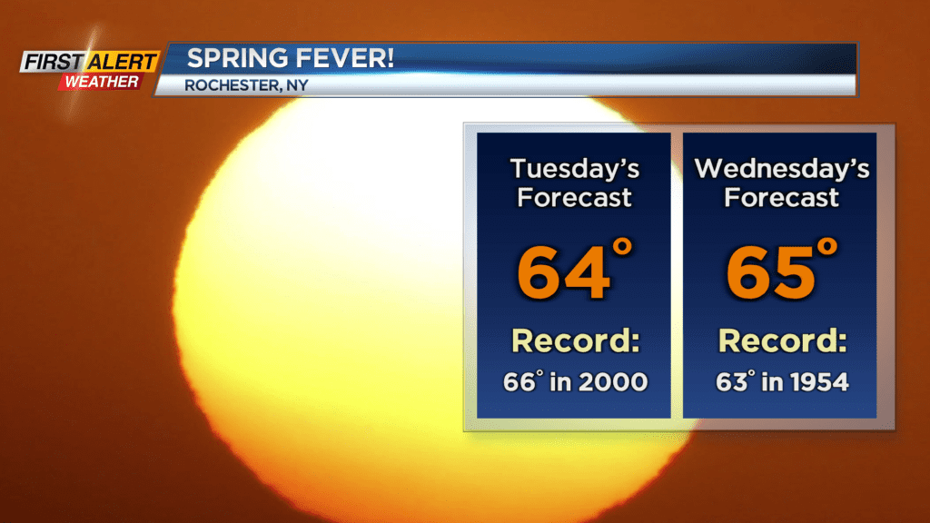
Near record warmth Tuesday as top temps climb into the 60s. A spot shower or even a thunderstorm is possible Tuesday evening. Wednesday will be a wild day with all sorts of weather headed our way. Initially we will have another shot at a record high with temps into the 60s midday and early afternoon. A strong cold front will arrive mid to late afternoon with some rain and thunder and then temps will dive into the 20s by evening.
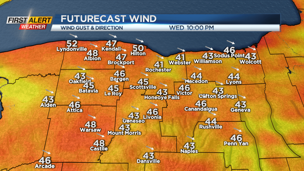
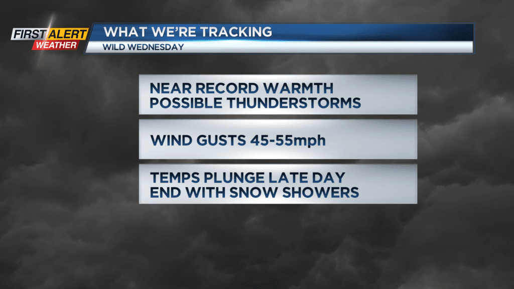
Behind the front a period of strong winds are possible with gusts to 50 mph. At this time it does not appear to be a damaging wind set up, but stay tuned for updates. And as hard to believe as it is the same day we may set a record high we will also have some snow in the forecast as the cold moves back in later afternoon into the evening.
It stays cold for a day on Thursday and then another warm-up arrives for the weekend. Stay tuned to News10NBC for the latest on possible record temps and the timing of precip later Tuesday into Wednesday.