First Alert Weather: Tracking thunderstorms for Western New York later Wednesday night
[anvplayer video=”5186606″ station=”998131″]
ROCHESTER, N.Y. — Earlier Wednesday, severe weather was focused across lower Michigan and northern Ohio.
In this part of the country, strong to severe thunderstorms have been producing gusty winds, hail, torrential rain, and frequent lightning. These storms are expected to move across Ontario, Canada Wednesday evening and eventually reach Western New York later Wednesday night. It is projected that these storms will weaken as they move east and when they finally reach Rochester at about midnight, the probability for severe weather should be greatly reduced.
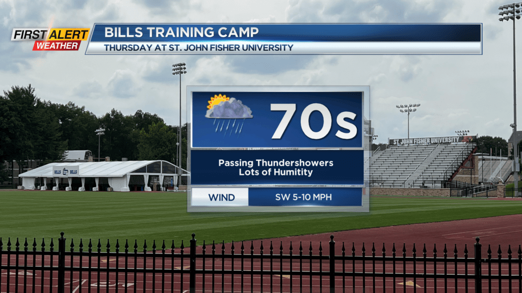
Look for hazy skies and a very muggy evening. Then showers and thunderstorms will move from west to east around midnight. The temperature will only fall to near 70 degrees. Thursday will bring more showers and thundershowers – especially for the morning. Then partial sunshine for the afternoon.
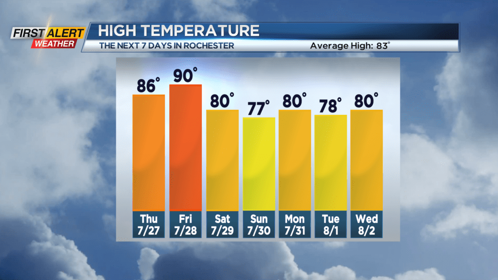
It will feel tropical with the high temperature in the middle 80s. The hottest day this week will be Friday with the mercury near 90 degrees. However, it should be a mainly dry day. Saturday will bring more showers and thundershowers for the morning, then a cold front will cross the area and bring a significant drop to the temperature and humidity for late Saturday and Saturday night. Sunday will be much more comfortable with lots of sunshine.