First Alert Weather: Tracking wildfire smoke for another couple days
[anvplayer video=”5180265″ station=”998131″]
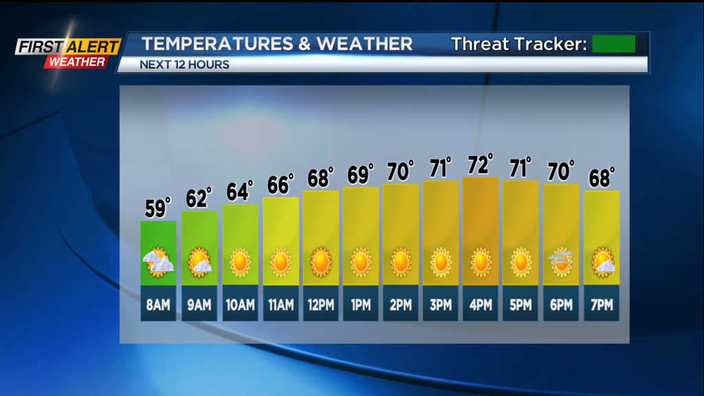
ROCHESTER, N.Y. — Hazy sunshine is in the forecast for Tuesday with temperatures into the 60s and low 70s this afternoon.
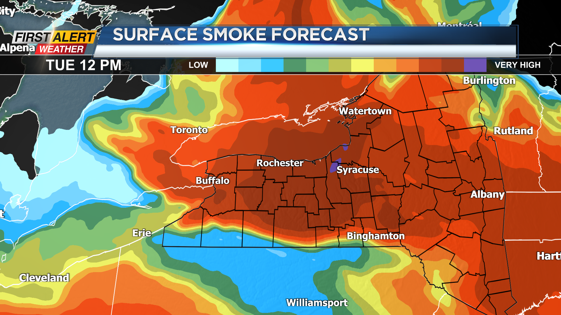
A northerly breeze will continue to bring the smoke from Canadian wildfires into the Rochester region. The thickest smoke today is forecast around midday into the afternoon with a little decrease on Tuesday night.
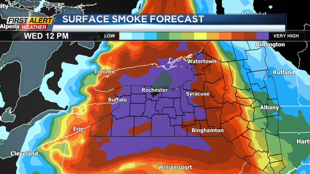
Another more impressive area of smoke is forecast to arrive on Wednesday with levels near the top of the chart over the Rochester region Wednesday.
For most of us, this is no big deal but people with lung issues need to be advised to take it a little slower with the smoke in the air today and especially for Wednesday. A cold front arrives on Thursday with cooler temperatures and a few showers expected to develop.
Stay tuned to News10NBC for the latest updates on the smoke forecast and some needed rainfall in the extended outlook.
______________
Download the WHEC First Alert Weather app to stay up to date while on the go.
Watch the latest full forecast online.