First Alert Weather: Tropical Storm Ophelia soaks the coast; WNY misses most of it
[anvplayer video=”5193194″ station=”998131″]
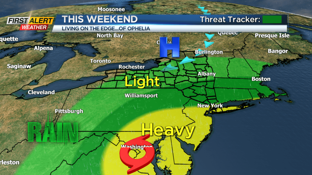
Our newest tropical system was officially named Friday afternoon. Tropical Storm Ophelia will drench the east coast from the Carolinas to the northeast this weekend. This means a soaking rain in and around the Washington, D.C. area, where the Buffalo Bills will take on the Washington Commanders on Sunday. As far as that weather goes, the worst of it will end Sunday morning, which means improving weather for the game. Still, some showers will be lingering, and it’ll be a little breezy. So, weather may have some impact on the Bills game this weekend.
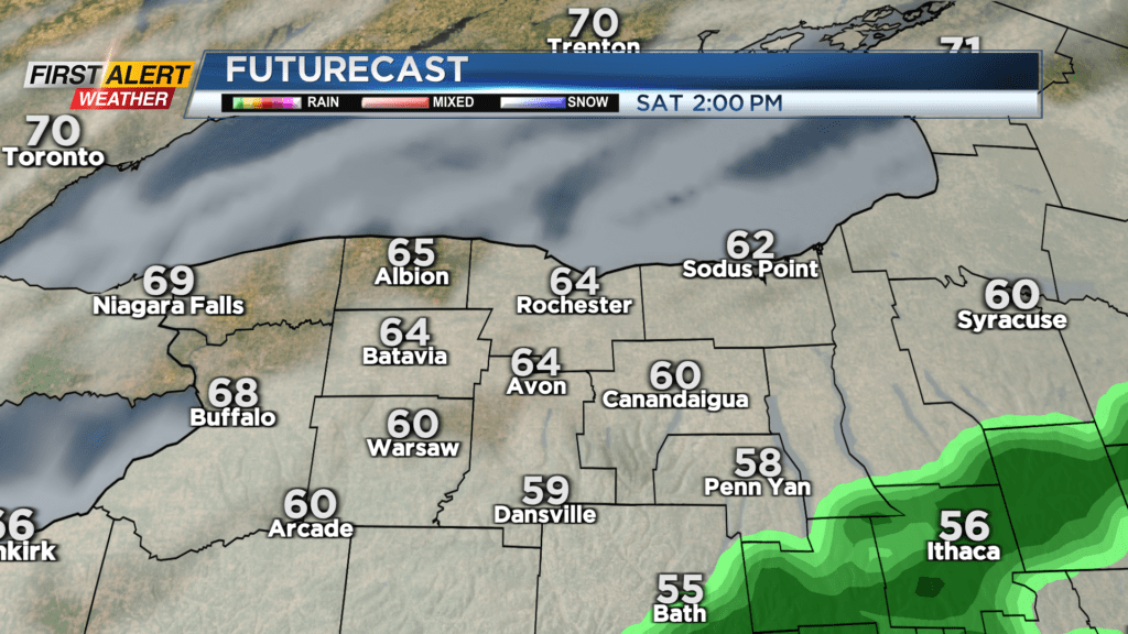
Locally, high pressure to our north will be funneling dry air into western New York, working to combat the tropical moisture trying to lift in from the south. The driest weather will be near Lake Ontario and west toward Buffalo. Meanwhile, the wettest weather in our area will be the southern Finger Lakes. Some of those showers will begin to move into southern NYS Saturday evening, and may spread a few showers into Yates and southern Ontario counties. There’s the chance a few showers could make it as far north as Rochester overnight Saturday and into Sunday morning, but anything we do get should be intermittent and light. As the low pulls away on Sunday, any rain will go with it.
Now, this is not a cut-and-dry forecast, and if the remnants of Ophelia make it just a little further north, we will likely see more showers in and around Rochester. Stick with the First Alert Weather team into the weekend for continuous updates.
Fall officially arrives at 2:50 Saturday morning, and our first full week of fall next week looks quite nice. High pressure will remain planted to our north, which will once again bring us a nice stretch of dry weather with a fair amount of sun and warming temperatures throughout the week.