First Alert Weather: Tying a record high temperature Saturday
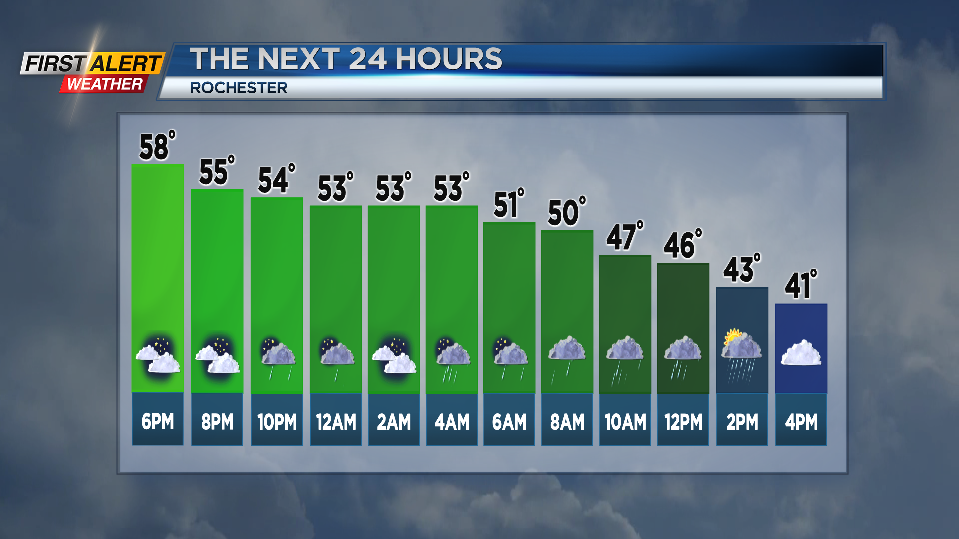
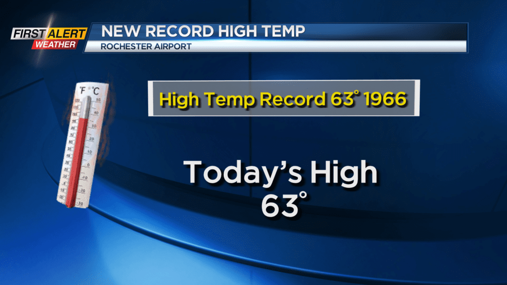
ROCHESTER, N.Y. – Saturday we tied the record high temperature as the mercury at the Rochester Airport equaled a record that has stood for 57 years. Lyndon Johnson was President the last time we reached 63 degrees back in 1966. The official high temperature today was also 63 degrees. Unfortunately, this pleasant weather will be coming to an end starting later Saturday night as a cold front approaches Western New York. This front will bring an increasing chance of rain showers and eventually some much colder weather.
Saturday night, look for cloudy skies with rain showers developing by the middle to late evening. It will be very mild with the low temperature within a few degrees of 50. Typically, this time of the year the temperature is falling into the upper 20s. Sunday the temperature will start near 50 degrees and then fall through the 40s with occasional rain showers. The greatest concentration of rain will be east of Rochester. Sunday evening the rain showers will mix with wet snow, especially in the higher elevations. However, any accumulation is expected to be less than an inch. Monday it is back to reality as it will be blustery and sharply colder as the temperature will remain in the 30s. Look for mainly gray skies with occasional lake snow showers.
Stay tuned to News 10 NBC First Alert weather for updates on the forecast.