First Alert Weather Update
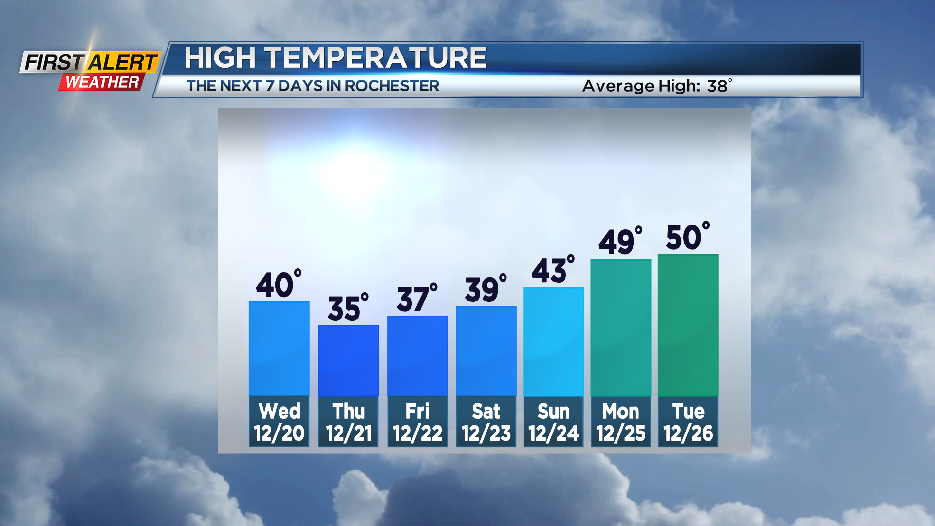
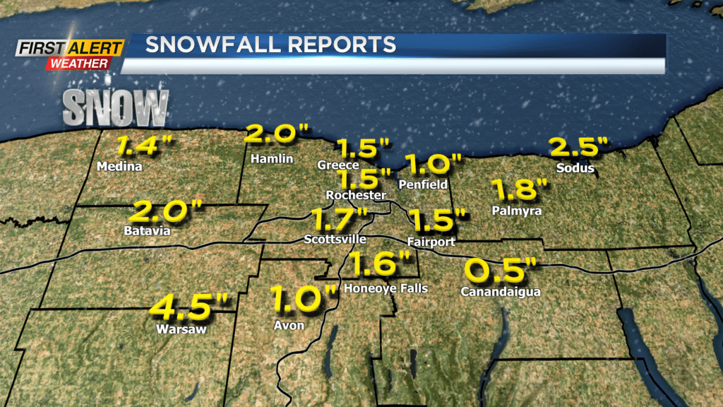
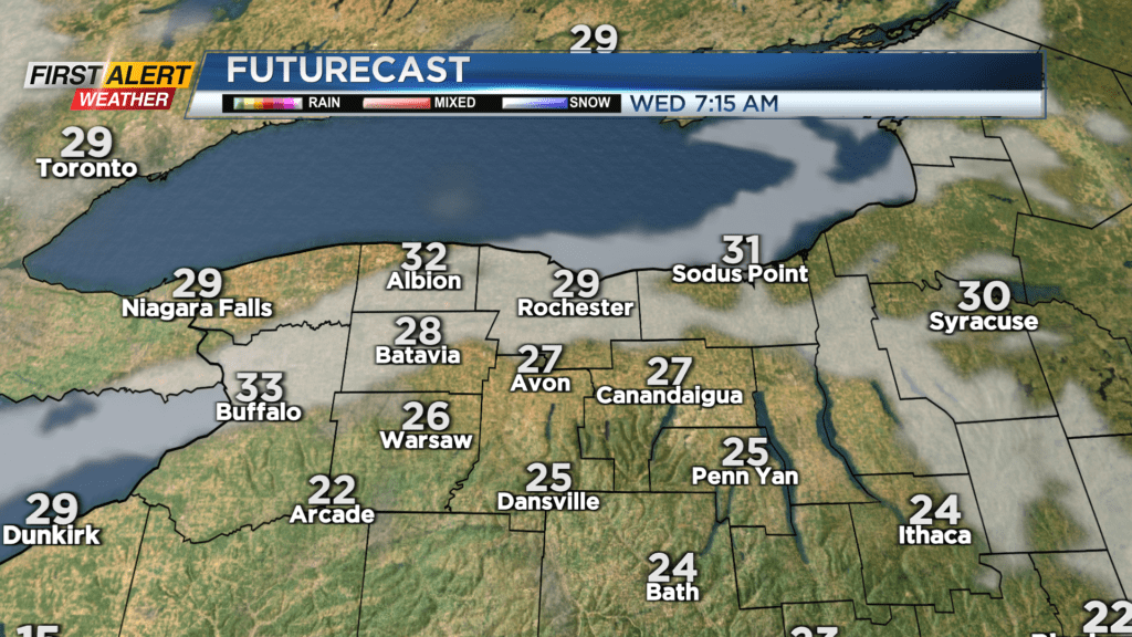
ROCHESTER, N.Y. – Tuesday morning’s snowfall brought a general 1-3” accumulation to the area, with a few spots picking up some slightly higher amounts. That should be all the snow we see through Christmas, though. Weak high pressure builds in, giving us some partial clearing overnight and into Wednesday. Temperatures will remain chilly, with overnight lows in the mid 20s. Highs on Wednesday will climb back to seasonable readings in the upper 30s to near 40. Another weak cold front drops south by Thursday morning, but expect little more than a few flurries and some clouds to start the day Thursday. We’ll see some clearing and sunshine returning, but temperatures will struggle. In fact, we’ll likely fall into the 20s later on Thursday. We’ll end the work week on a high note with some sunshine, but temperatures will remain chilly in the 30s. This should help to retain some of the snow on the ground, though we’ll slowly be losing it through the week, thanks to that sunshine.
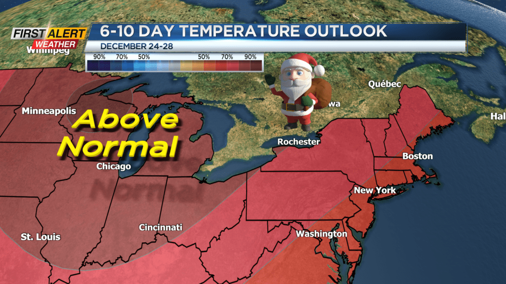
Saturday may see a few rain or wet snow showers, but nothing that should get in the way of any last minute shopping, errands or holiday travel you may have planned. Sun returns on Sunday, and we’ll begin a warming trend leading into Christmas Day. Christmas Eve highs will make it back into the 40s, with temperatures pushing 50 on Christmas Day. This is when we’ll lose any snow that fell early this week. Our quiet weather will continue through Christmas, but a developing storm system will bring us another round of rain by Tuesday, and it’ll likely stick around into the middle of next week.