First Alert Weather: Very active weather pattern this week
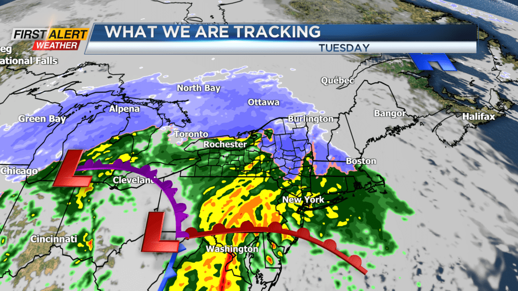
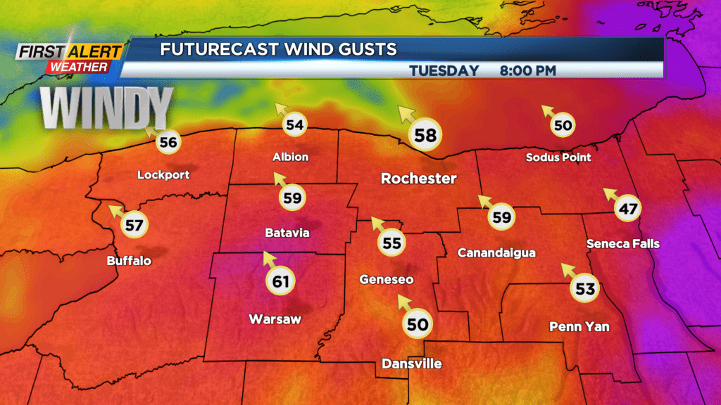
ROCHESTER, N.Y. – The next 36 hours is looking rather calm, but the News10NBC First Alert meteorologists are already tracking the next storm system. This next low-pressure system will strengthen quickly as it moves into the Great Lakes by Tuesday. The greatest concern with this storm will be the potential for strong winds. As a result, the News 10NBC has issued a yellow alert for later Tuesday and Tuesday night.
Sunday night, look for mainly cloudy skies with just a small chance of passing flurries or a snow shower. The low temperature will be in the middle 20s. Monday the skies may brighten from time to time, otherwise it will be mainly cloudy and dry. The temperature is expected to rise into the upper 30s. Tuesday wet snow showers will change to rain showers with the temperature rising into the middle to upper 40s. News 10NBC has a yellow alert for later Tuesday afternoon and evening. There is the potential for strong winds to gust more than 55 miles per hour. The highest probability for the damaging winds will be in the higher elevations south of Rochester. The winds will slowly diminish during the day on Wednesday.
Stay tuned for News 10NBC First Alert weather for updates on the forecast.