First Alert Weather: Warm air comes with passing showers to end the week
[anvplayer video=”5196854″ station=”998131″]
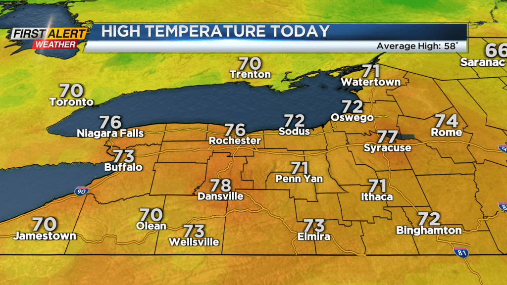
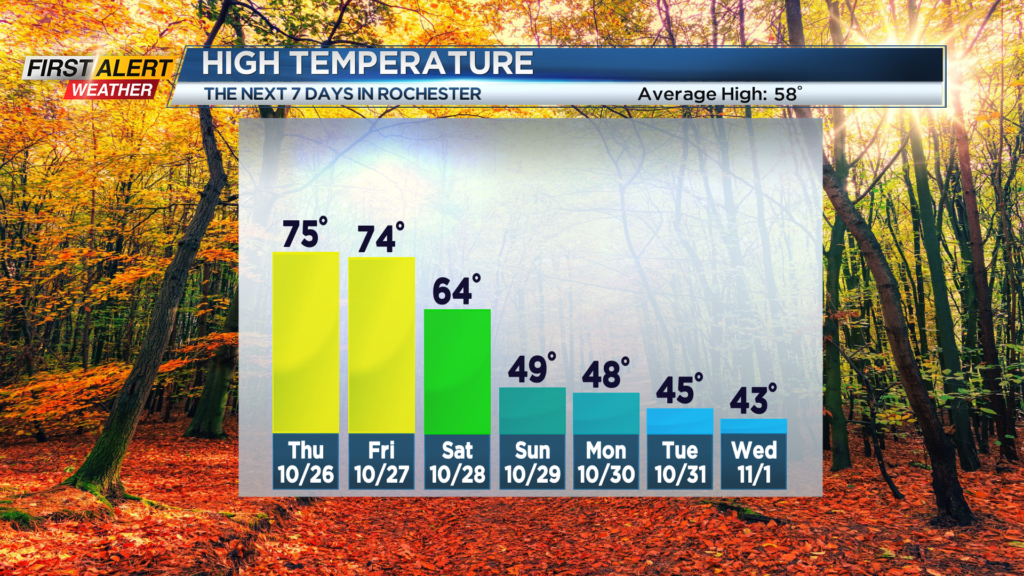
ROCHESTER, N.Y. — Our unseasonably warm late October air will continue through the end of the work week, with highs in the low to mid 70s both Thursday and Friday, with overnight lows only falling into the upper 50s.
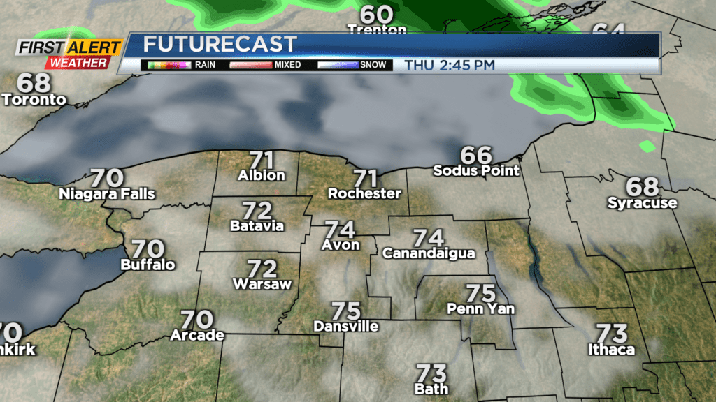
A boundary hovering just to our north will allow a few showers to work in Wednesday night into early Thursday, and perhaps a few more passing showers on Friday. The majority of the time will be dry, though, with some limited breaks of sun. A cold front will slowly begin to sag southward over the weekend, dropping us back through the 60s into the 50s on Saturday, and likely holding in the 40s on Sunday.
As far as rain goes this weekend, we’ll see a few showers on Saturday, especially in the morning, with another round of more widespread rain developing on Sunday.
Our pattern flip continues into much of next week, with highs in the upper 40s on Monday, then lower to mid 40s on Tuesday and Wednesday, before some moderation by late week. Looking at the Trick or Treat forecast for Halloween, we’ll likely see a chillier evening, with temperatures in the lower 40s and a passing rain or wet snow shower.
There continues to be indications that we’ll see our first flakes of the season through the middle of next week, but no accumulation expected locally.