First Alert Weather: Warm, dry and sunny weather returns to end the work week
[anvplayer video=”5133888″ station=”998131″]
ROCHESTER, N.Y. We were finally able to erode most of the cloud cover that has plagued us throughout the week, with a continued clearing trend into tonight.
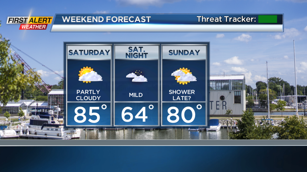
It’ll become mainly clear tonight, with lots of stars. Friday will be a beautiful day with highs into the lower 80s and nearly full sunshine. This weekend will feel like a classic late summer weekend, with highs in the mid 80s on Saturday under a partly cloudy sky, and near 80 on Sunday.
Saturday will still be the better of the two weekend days, with the slight chance for showers to develop later on Sunday. But the majority of the weekend will remain dry.
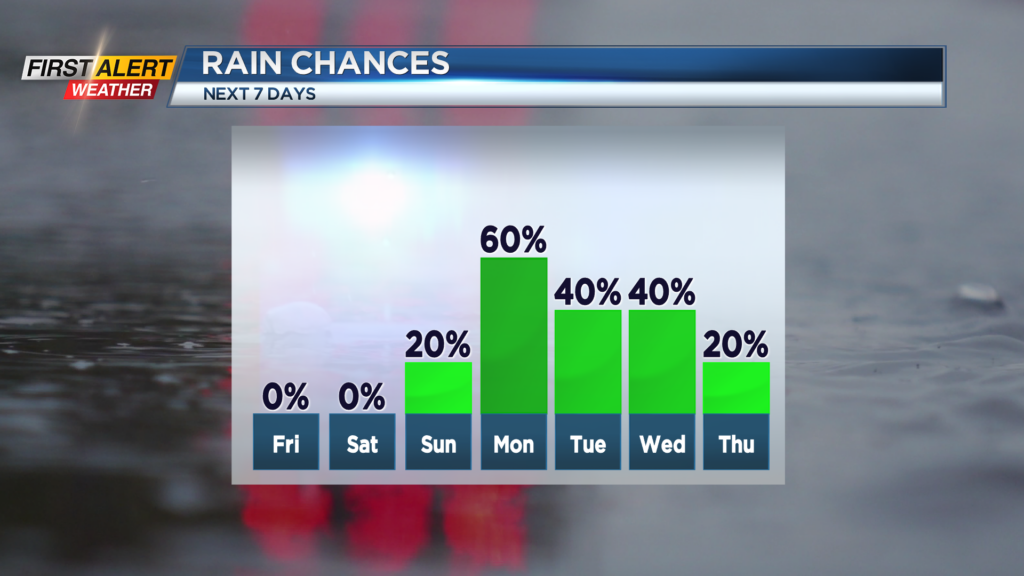
We’re still tracking an area of low pressure moving into the Great Lakes next week, which will bring a return to more unsettled weather starting on Monday. Showers and some thunder will develop with an initial batch of moisture ahead of the low on Monday.
Although rain is still in the cards on Tuesday and Wednesday, we should see a period of dry weather mixed in, so far from a washout. This next area of low pressure shouldn’t get “stuck” like this last one did, meaning we’ll clear things out quicker by Thursday, and even see some sunshine in the mix next week.
We’ll work to fine tune the timing of rain and any storms next week over the next few days. But severe weather isn’t expected, so we’re green on the First Alert Threat Tracker.