First Alert Weather: Warm end to the week, then bracing for arctic outbreak
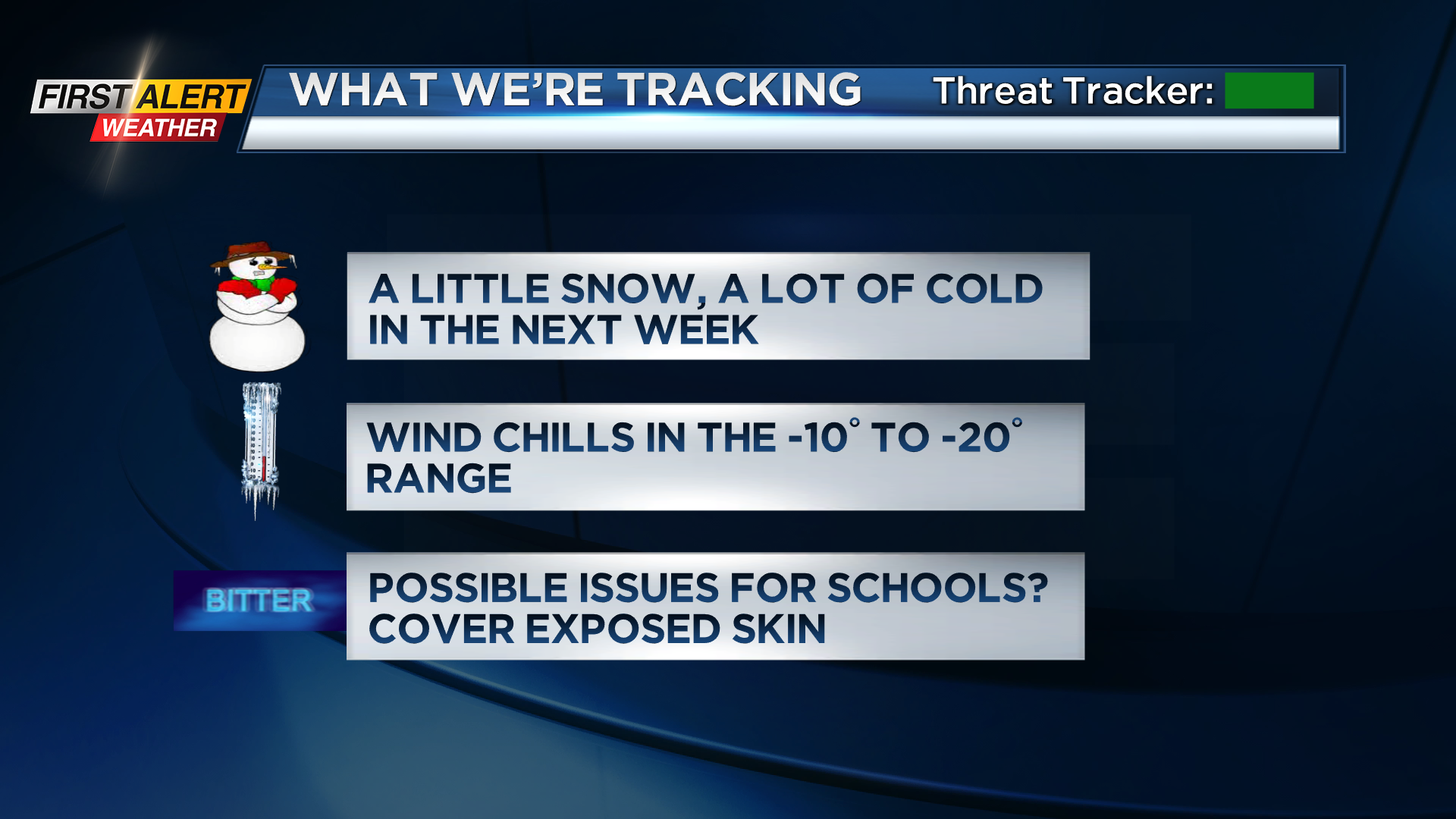
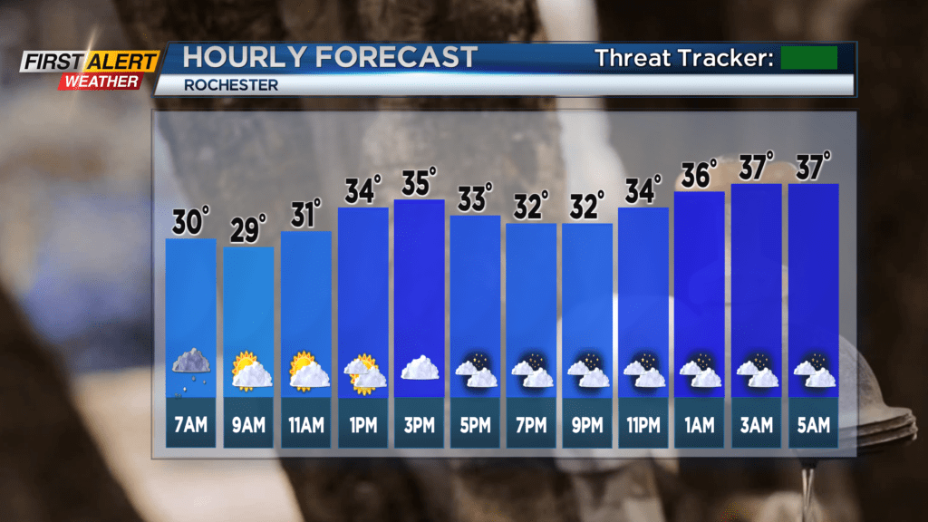
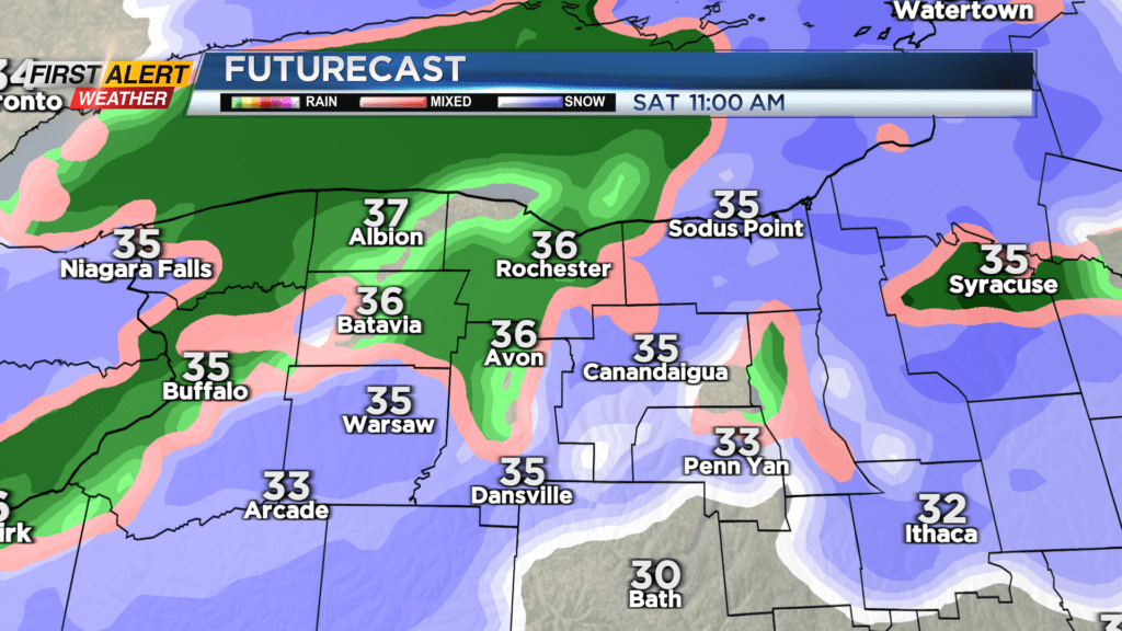
ROCHESTER, N.Y. We, as well as the rest of the U.S., are in for a major cooldown next week as an outbreak of arctic air will sweep the nation. But before that, we’ll be able to enjoy the end of the workweek with some above average temperatures. Today we’ll have some snow showers in the morning coming in from the west, but behind them is some dry air creeping in, which will give us partly sunny conditions for the rest of the day. Winds will be light in the A.M. and then increase going into the night, and temperatures will get up to the mid 30s. Tomorrow moisture coming from the southwest will converge with an incoming cold front, which will produce a mix of rain and snow. Temperatures could potentially get up to the low 40s depending on the strength of that southwest flow and advection of warmer air.
After the cold front passes, the arctic air outbreak will begin. An upper-air trough spanning the width of the nation will dig all the way down to the gulf coast, allowing frigid arctic air to flow in behind it. This will be the case for a few days; with the trough gradually directing the arctic air east.
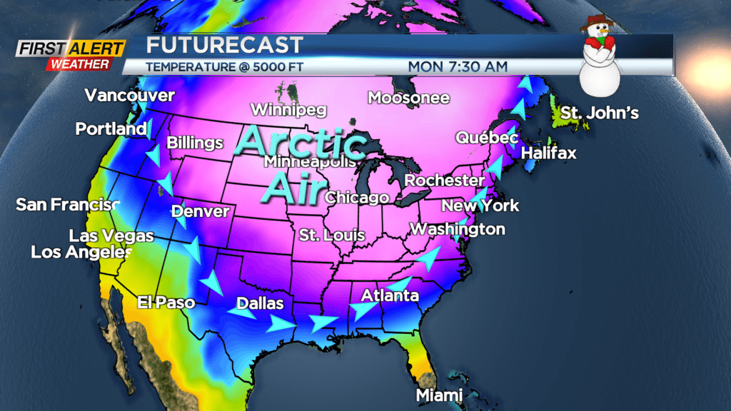
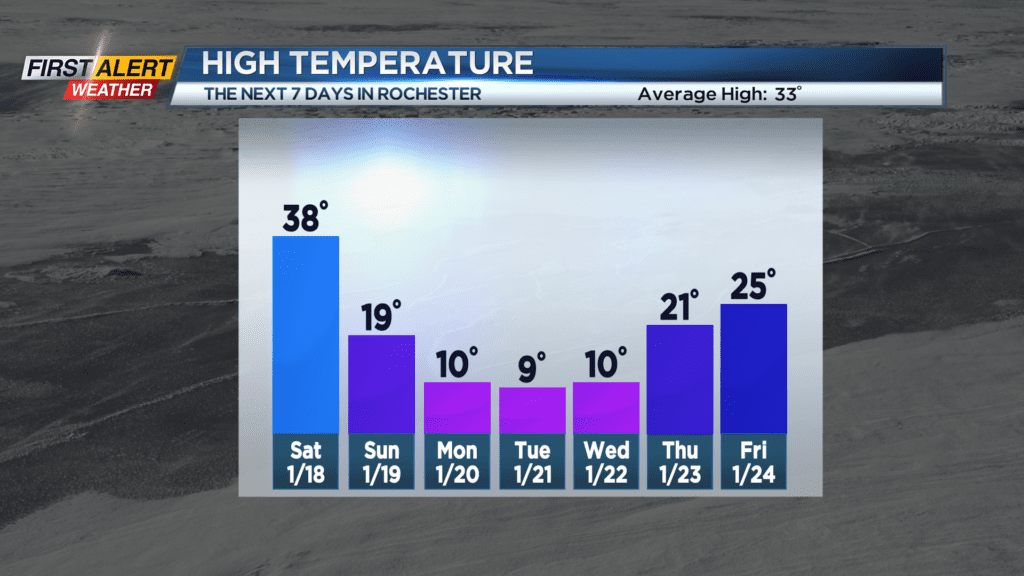
Alongside the arctic air will be winds that make the already brutally cold temperatures feel well below zero at times. It goes without saying that this will be hazardous to anyone staying outside for extended periods of time… Please take necessary precautions and bundle up if you are going outside for any reason during this outbreak of arctic air.


Stay tuned to News10 NBC for all your First Alert Weather updates as we continue to monitor this piercingly cold airmass.