First Alert Weather: Warmer air and some storms returning Thursday
[anvplayer video=”5188914″ station=”998131″]
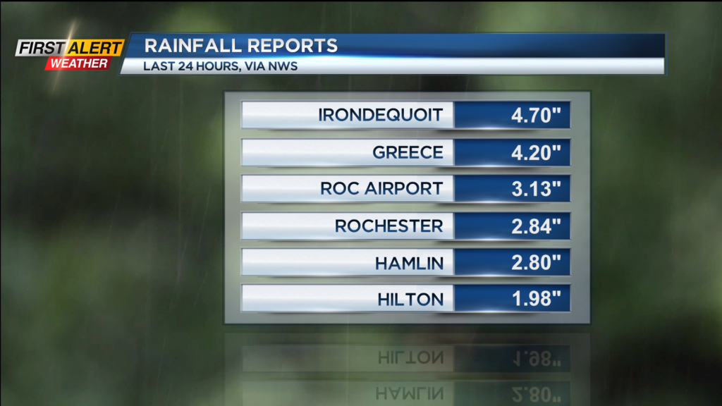
The drenching rains that produced localized flash flooding across parts of the Rochester region Wednesday morning is long gone, but dropped impressive numbers, with amounts pushing nearly 5 inches of rain near Irondequoit. High pressure continues to build in tonight, with a mainly clear sky and temperatures dropping back into the lower 60s.
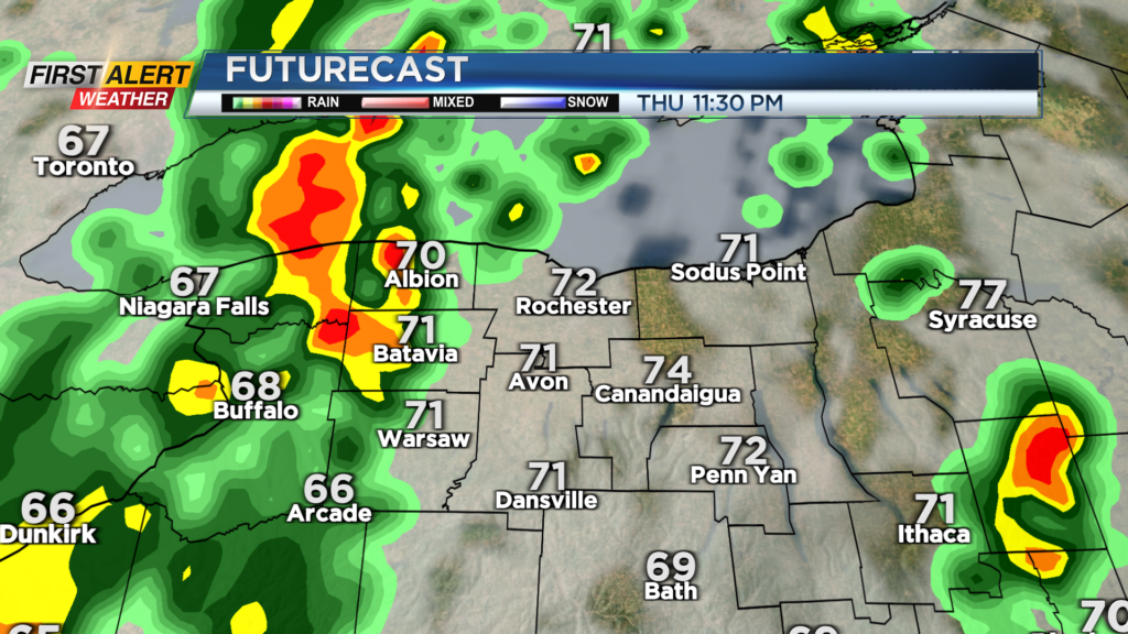
Warmer air blows in on Thursday with a southerly wind, pushing back into the mid 80s. Most of the day will be dry, but a few isolated showers or a storm may pop up ahead of our cold front. The cold front itself moves through around midnight, so our severe potential will be greatly reduced. Still, a gusty storm with heavy rain is possible Thursday night into early Friday morning. Much cooler air blowing in on Friday will keep highs in the upper 60s and lower 70s much of the day, along with a few pop-up showers during the afternoon.
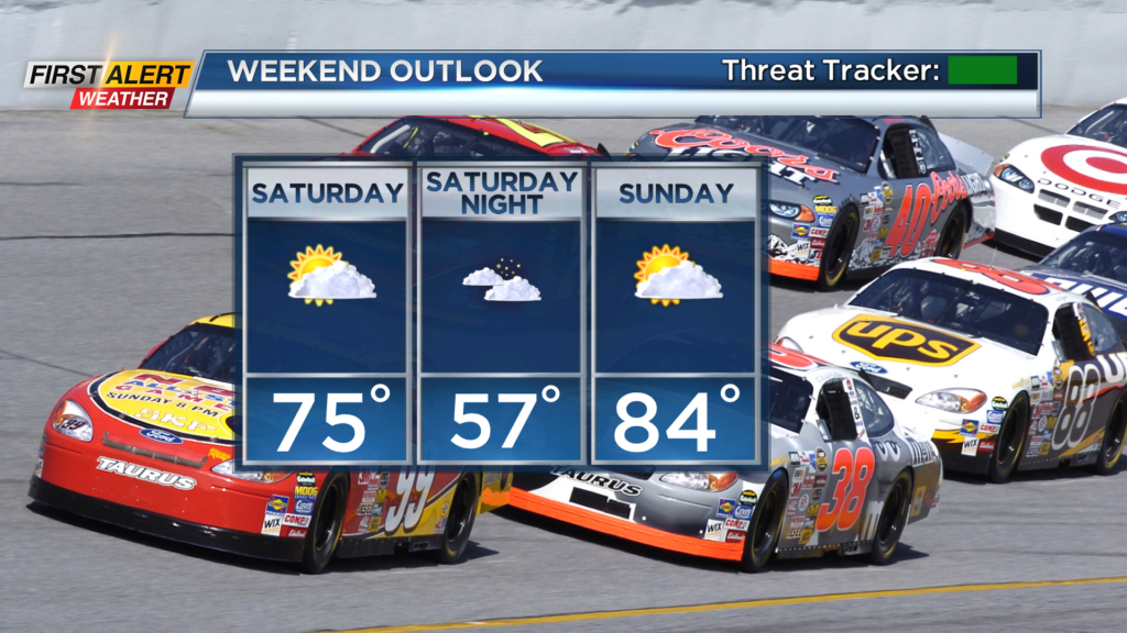
The weekend looks nice, with cooler and fresh air, along with clouds and sunshine on Saturday, and warmer air back into the 80s on Sunday. Weather looks nice for NASCAR at Watkins Glen, if you have plans to spend the weekend there.
Some big heat building across the central U.S. will try to move east at points next week, but there is still some uncertainty how far east it will make it, and how long that warmer air may last across our area. We’ll of course keep you posted!