First Alert Weather: Warmer weather ahead for remainder of the week
[anvplayer video=”5173270″ station=”998131″]
ROCHESTER, N.Y. — We’re waking up to chilly conditions once again as temperatures have dropped into the upper 30s on Wednesday morning.
We are also stuck under overcast skies but sunshine is expected to return. On Wednesday morning, we will have the chance for a passing sprinkle or flurry but the clouds break this afternoon and give way to partly cloudy skies.
Also, after a chilly start to the day, our afternoon highs will be a bit milder than Tuesday as they reach near 50 degrees. After a pleasant Wednesday afternoon and evening, clouds will roll back into our region and bring another chance for showers late tonight and early tomorrow morning.
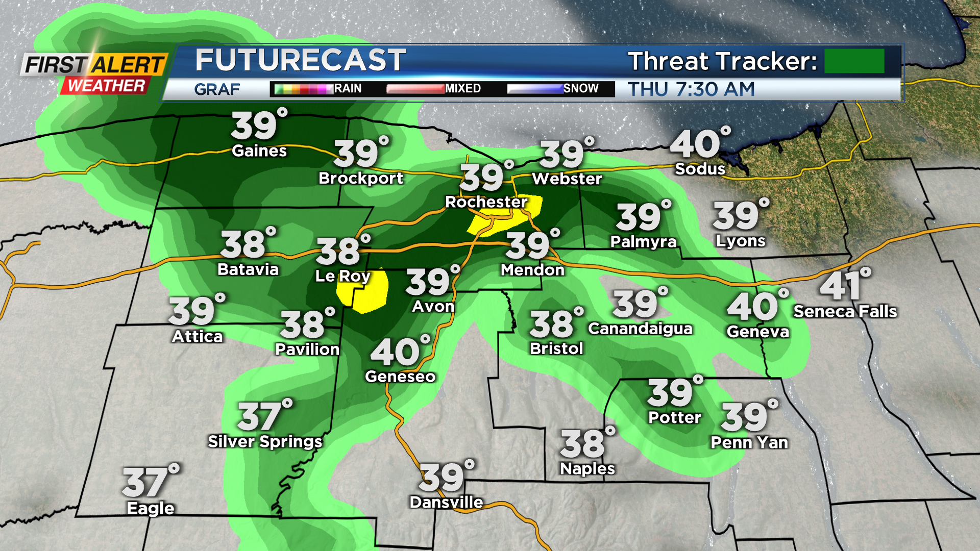
A few passing showers will be possible after midnight tonight, and those chance continue into early tomorrow morning. This is thanks to a warm front that will stall across our region for Thursday.
After a few showers early Thursday morning, we will see the sun return in the afternoon, but the stalled front will have an impact on our afternoon highs.
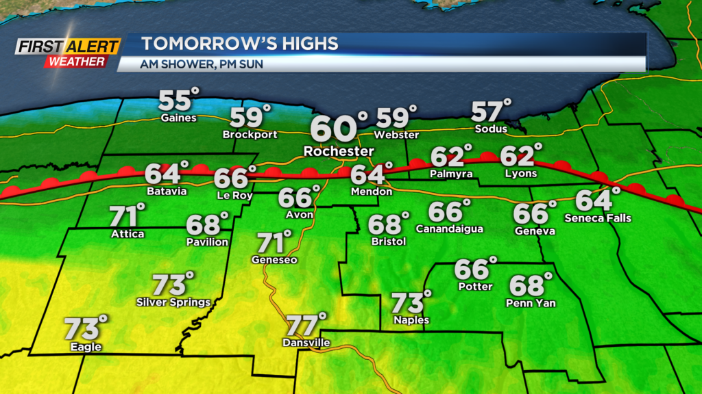
Thursday’s highs will depend on your location. North of the thruway, you will likely be stuck in the upper 50s to near 60 degrees. Folks south of the thruway will have a chance for afternoon highs in the 60s and even low 70s. Although some will miss out on the warmth tomorrow, all of us will see it on Friday.
______________
Download the WHEC First Alert Weather app to stay up to date while on the go.
Watch the latest full forecast online.