First-Alert Weather: Warmer weather returns, then wet weather returns
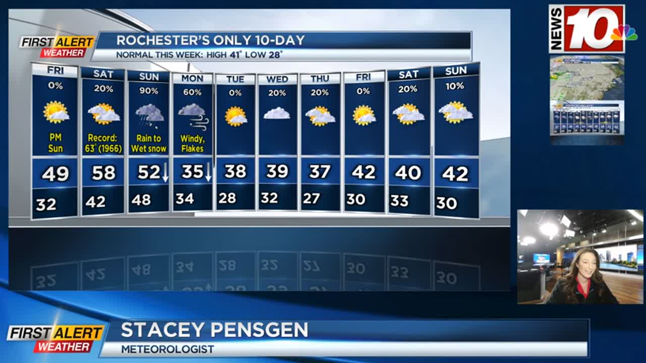
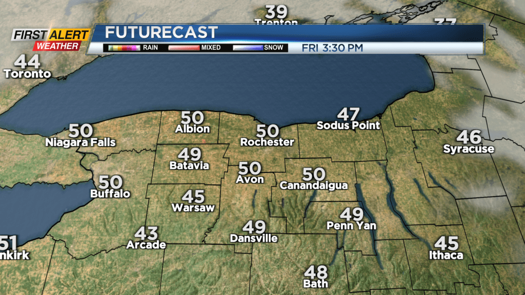
We’ll be taking a break from the winter weather for the next few days, as much milder air works back in. Friday will start off mostly cloudy, but we’ll see a clearing trend, leading to at least some sun to end the work week. Highs on Friday should flirt with 50 degrees. Saturday will be mostly cloudy once again, but mainly dry and quite warm for December. We’ll be pushing into the upper 50s by the afternoon. The record stands at 63, so that number should be safe. Outside of the slight chance of a shower late in the evening, we’re dry.
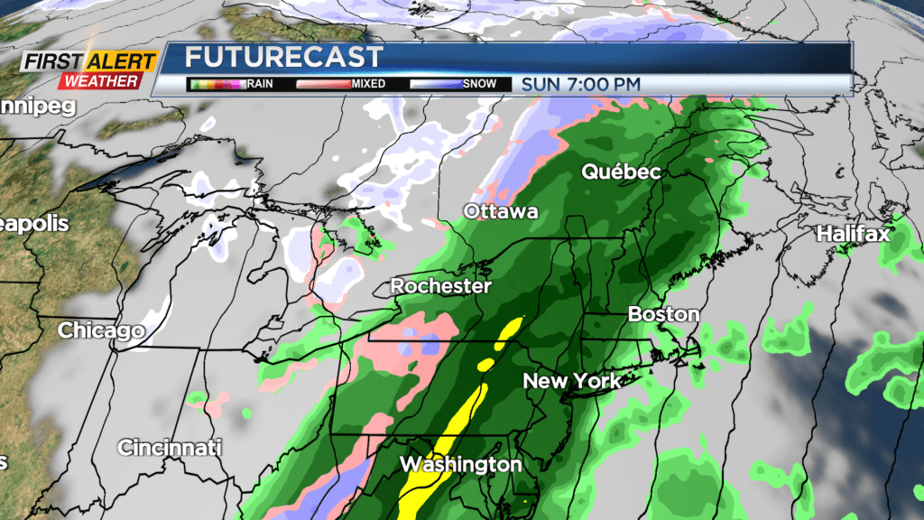
That changes on Sunday. A steady rain will be developing as a large storm system approaches. Expect a near washout on Sunday, with temperatures dropping from the lower 50s into the 30s. It’ll turn cold enough for rain to mix with and eventually change over to some wet snow, with the best chance of a few inches of accumulation coming in the hilltops south of Rochester Sunday night into Monday morning.
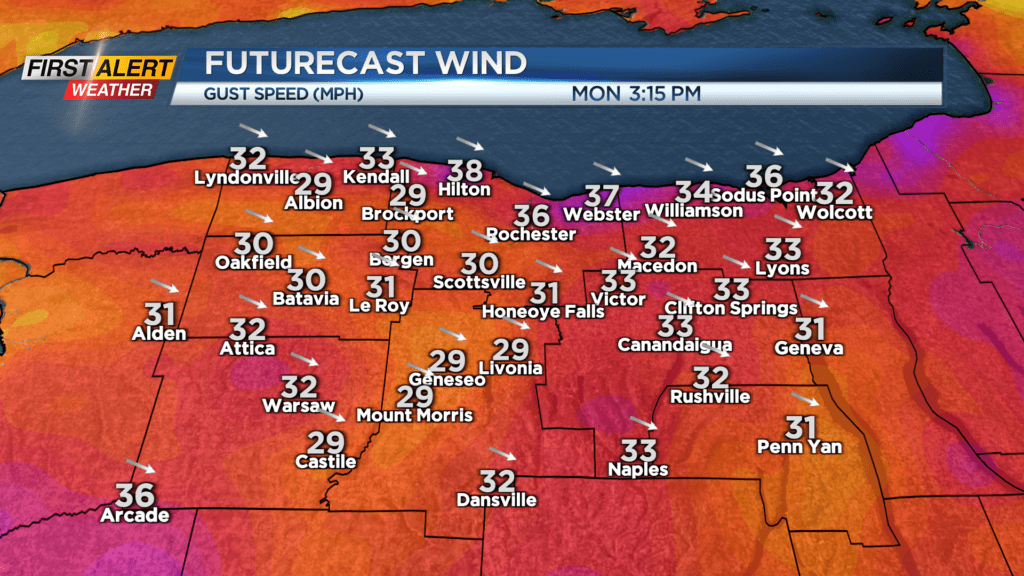
Temperatures continue their downward trend on Monday, and we’ll see some limited lake effect. Winds will turn gusty on Monday, with some gusts 30-40 mph. So, the majority of the precipitation from this weekend’s storm appears to fall in the form of rain, though some snow is still on the table for parts of the area.
Much of next week will feature near average temperatures and fairly quiet weather with just a few passing rain or wet snow showers.