First Alert Weather: Warmth and sunshine return
[anvplayer video=”5142971″ station=”998131″]
ROCHESTER, N.Y. We spent the majority of this week much cooler than average with lots of clouds and lake rain/snow showers, but that pattern is ending tonight.
The big area of low pressure and trough finally moves east, allowing high pressure to build in. Our sky will clear tonight, setting the stage for a much brighter and milder day on Friday. Highs should reach the lower 60s under a mostly sunny sky.
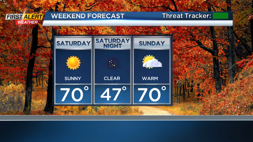
The weekend couldn’t be nicer, especially with peak fall color occurring across Rochester and the Finger Lakes right now. We’ll see a nearly flawless blue sky on Saturday and a slight uptick in cloud cover by Sunday afternoon. Highs on both days should flirt with 70.
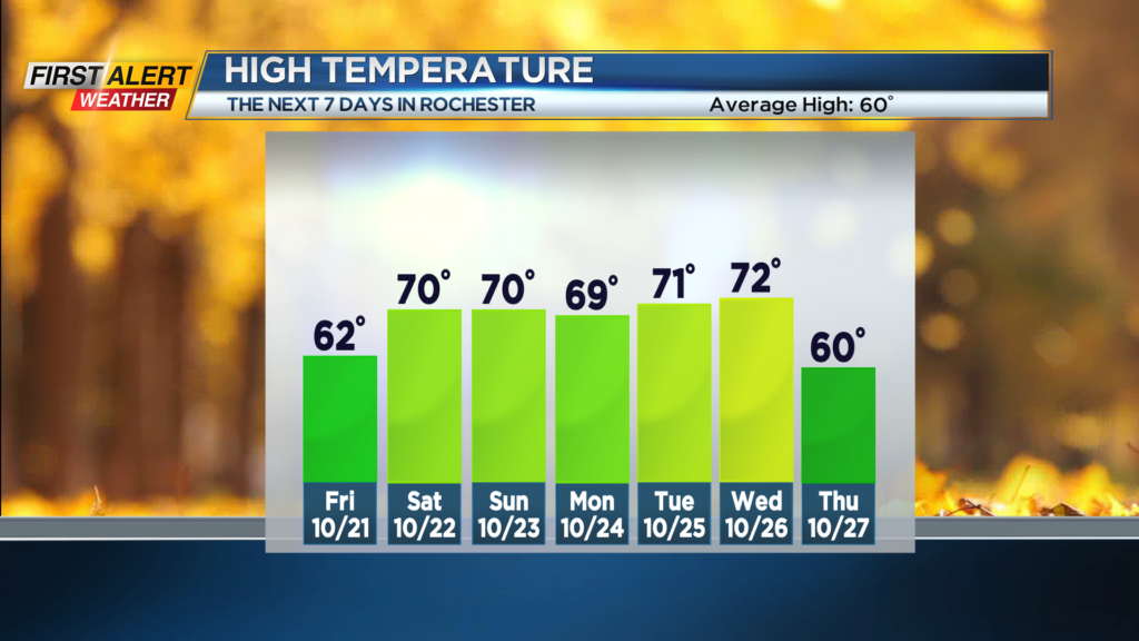
We’ll keep that warmer air around for a good part of next week, along with the dry weather. The one thing we need to watch is a coastal system that may try to spread a shower or two into the Finger Lakes Sunday night into Monday morning.
We’ll see a better chance for some showers and an eventual breakdown in the warmer pattern by the end of next week, or perhaps even next weekend. In the meantime, enjoy the fair weather and warm air!