First Alert Weather: Wet for Monday before we track gusty winds later this week
[anvplayer video=”5150064″ station=”998131″]
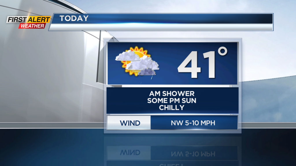
ROCHESTER, N.Y. — Waking up this morning to a bit of a wet and chilly start. A little drizzle and light fog will be possible early this morning before we slowly dry out by the afternoon. Cloud cover will stick around through a good chunk of today with limited sunshine expected, but some sun will be possible this afternoon.
Temperatures will also be on the chilly side, and after starting off near 40 degrees we will end up near 40 degrees this afternoon. Things really begin to clear out late tonight as clouds break apart late. Temperatures will cool off tonight with temperatures starting off near 30 tomorrow morning before warming up. Tomorrow, we are expecting partly cloudy to mostly sunny skies with highs in the mid and upper 40s. Not a bad day tomorrow, but this is when we will be tracking our next weather maker for Wednesday and Thursday.
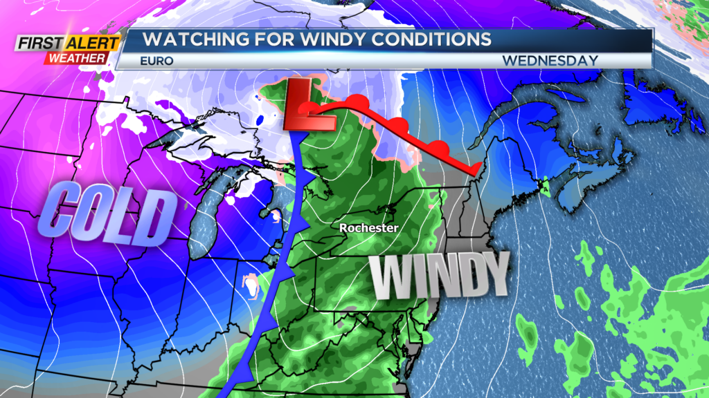
Wednesday will consist of mild, but wet weather as shower rolls in. This is thanks to a potent cold front that will move through late Wednesday evening.
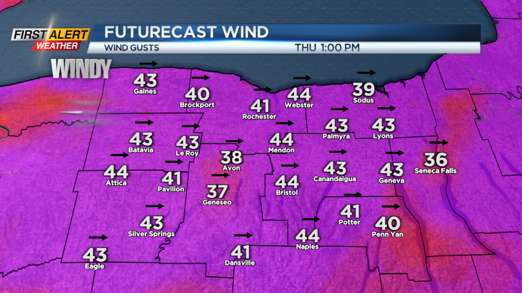
This cold front will bring us scattered shower chances from the morning hours and through the evening on Wednesday with windier conditions also. Winds will be gusting to near 40mph late Wednesday before ramping up to over 40mph Thursday as cold air moves in.
We will also have an opportunity for lake effect snow showers, but the big story will be the winds. With winds gusting over 40mph at times on Thursday, there will be the chance for isolated power outages across our region. Also, make sure loose belongings and loose Christmas decorations are tied down securely with the gusts expected.