First Alert Weather: Wet weather continues next weekend
[anvplayer video=”5196095″ station=”998131″]
ROCHESTER, N.Y. — This weekend has been a bit of a wet one thus far, and that will continue Sunday.
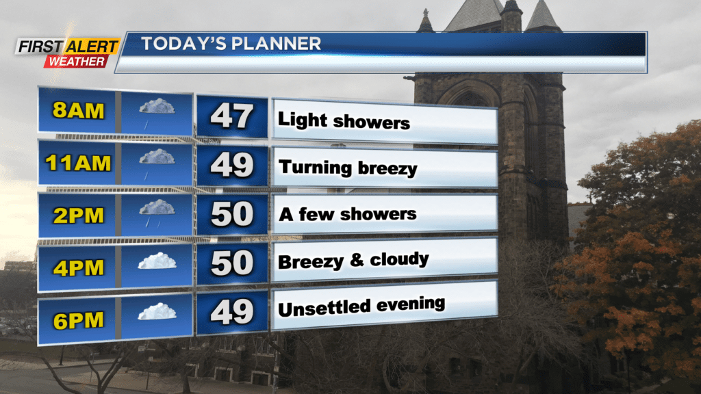
Sunday, we will see a lot of cloud cover once again with occasional rain showers. Lake effect rain showers will continue through the morning and into the afternoon before we try and dry out a bit this evening. A rain out is not expected, but on and off showers will be possible through the day. We will also be on the chillier side of things with highs only near 50 degrees. It will also be a bit breezy with gusts near 20mph.
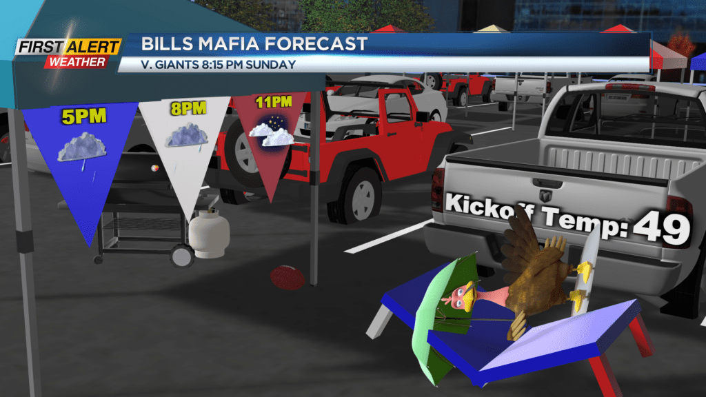
The unsettled and breezy conditions will persist into early the evening locally, and out towards Buffalo. Bills and Giants fans headed out to Highmark Stadium for the game should make sure they have the poncho, and an extra layer or two underneath their jersey as temperatures will be in the 40s along with a shower or two.
Shower chances continue into Monday, but a rain out is still not expected. Some sun will be possible Monday and we will be a bit warmer with highs in the mid-50s. We will see the sun return Tuesday, after a morning shower, and that sun will warm us up to the upper 50s. We continue to warm up through Thursday of this week with highs in the mid and upper 60s.
Clouds will increase Thursday with the slight chance for a shower late, but a better chance for showers arrives Friday afternoon and next weekend. Low pressure will once again approach late week with a shower Friday afternoon and then more showers expected next weekend as the unsettled weather generally continues.