First Alert Weather: Wildfire smoke and sticky air return to Rochester
[anvplayer video=”5187379″ station=”998131″]
ROCHESTER, N.Y. — We saw another comfortable and beautiful day on Wednesday, but you probably noticed some haze dulling our blue sky.
Some wildfire smoke has returned from Canadian wildfires out west. This will become more noticeable into Thursday afternoon as our winds increase out of the south. Our air quality may drop just a little bit. That southerly wind will boost our temperatures and dew points on Thursday. Highs will climb into the mid 80s and dew points back into the 60s. Some showers and thunder from Wednesday night should clear the area by 8 or 9 Thursday morning, which should mean dry weather for Bills Training camp.
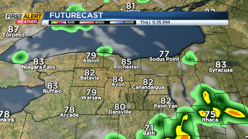
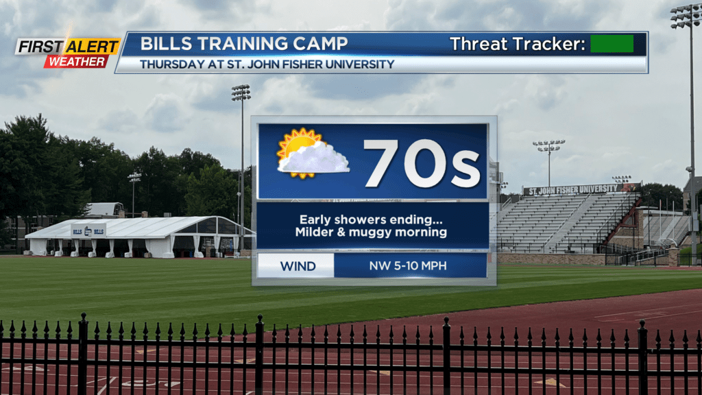
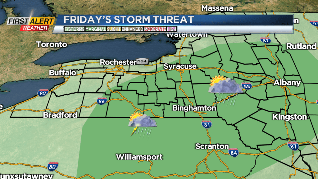
That being said, the timing will be close, and if you have tickets to practice, you should watch News10NBC Today starting at 4:30 with Rich Caniglia for updated timing. Much of Thursday will be dry and warmer, with a cluster of thunderstorms north of Lake Ontario. There’s the chance a few of these may drop into our area late Thursday night. We’ll see a better chance for some storms on Friday, especially in the Finger Lakes during the afternoon. The best chance for some gusty storms and heavy rain will be south of Rochester.
We’ll see fair weather return for the weekend, with upper 70s and lower humidity on Saturday, and lower 80s on Sunday.