First Alert Weather: Winds slowly ease; Tracking lake effect snow and cold on Thursday
ROCHESTER, N.Y. — Our Yellow Alert from Wednesday afternoon and night has expired as winds have eased a bit overnight.
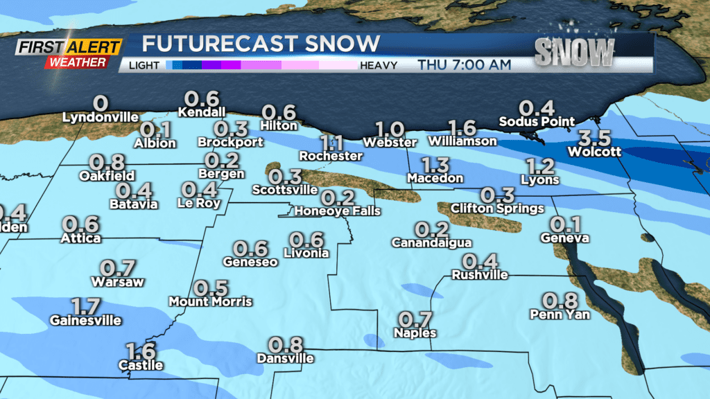
It will still be windy on Thursday morning but the damaging wind gusts should be all but done. Meanwhile, lake effect snow will become more organized by Thursday morning.
The most persistent snow will likely occur into northern parts of Wayne County, where 3-6 inches could fall overnight into Thursday morning, before lifting north.
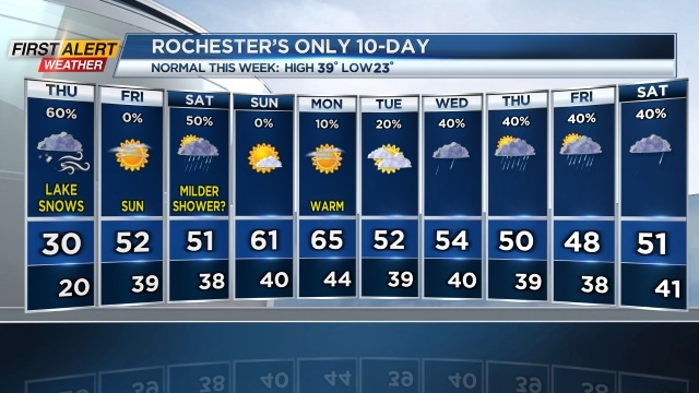
While we’ll likely see some snow into Monroe County and the Finger Lakes, amounts should be less than an inch or two. It’ll be blustery with some blowing snow and temperatures much more typical of the last (bonus day) of February.
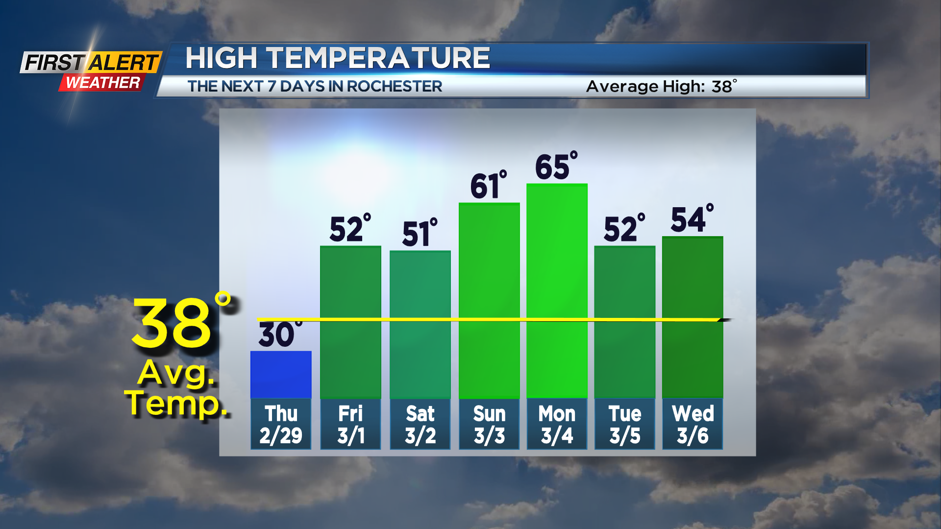
That being said, the chill won’t last. We’ll be back to spring-like weather starting on Friday with highs back into the 50s with dry weather and a good deal of sunshine. We’ll keep it mild into the weekend, with 60s returning by Sunday, and near record warmth possible on Monday of next week.
We may turn a little more unsettled toward the middle to end of next week with occasional showers, but we remain well above average temperatures, which means it’ll be rain and not snow showers.
So, March will come in like a lamb. Does that mean it’ll go out like a lion? We’ll just have to wait and see.