First Alert Weather: Windy on Tuesday and snow on Wednesday
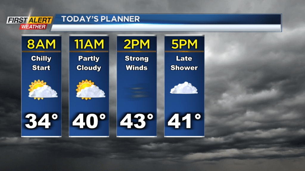
ROCHESTER, N.Y. — We’re waking up to a chilly start on Tuesday as temperatures have once again dropped into the 30s.
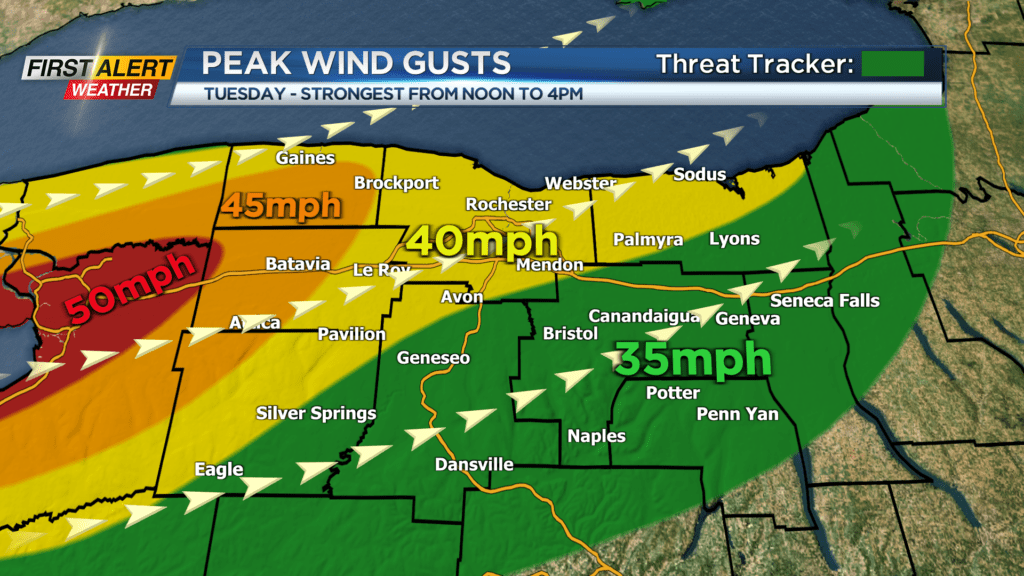
Temperatures in the afternoon will be milder than Monday as they reach the 40s, but it will come with stronger winds. A wind advisory is in effect for Genesee and Orleans Counties until 6 p.m. on Tuesday as they will see the strongest gusts.
The strongest gusts will be from around noon to 4 p.m. Tuesday. Winds across most of our region will be gusting between 30 and 40 mph, while the counties under the wind advisory will be gusting between 40 and 50 mph. Power outages are not likely, but still possible.
The main take away from today will be to strap down your holiday decorations to protect them from the stronger winds. A cold front will pass through our region this evening with a passing shower possible.
Once this front passes by the winds will calm down a bit but we remain breezy with gusts near 30mph for Tuesday night. Behind this front will be colder air that will bring us some snow on Wednesday too.
Snow showers will be possible into Wednesday morning, but lake effect snow showers do not get going until Wednesday afternoon. Snow showers could be heavy at times Wednesday afternoon and evening limiting visibility yon the roads.
A snow-covered road or two is not being ruled out either. Snow showers will continue through Wednesday night before drying out by Thursday morning.
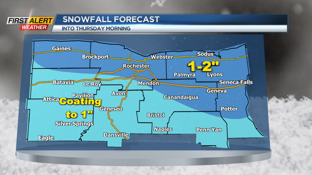
When it is all said and done, an inch or tow of snow is possible for those north of the thruway and east of Rochester. Otherwise, everyone else can expect a coating to an inch of snow.