First Alert Weather: Winter feels today, but a Spring surge this week
[anvplayer video=”5168456″ station=”998131″]
ROCHESTER, N.Y. – Waking up to a cold and windy morning across Western New York and the finger Lakes on this Sunday. The winter chill will continue through today, along with the wind and snow shower chances.
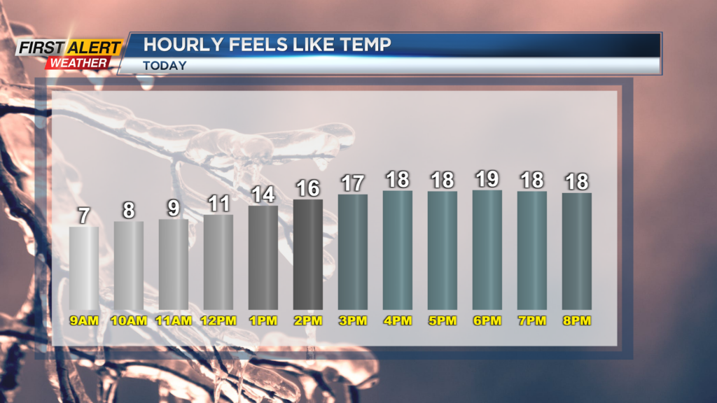
Temperatures will only make their way into the mid and low 30s this afternoon, and with the wind gusting to near 40 mph it will feel like the teens through much of the day. Snow showers today will also have a chance to drop visibility from time to time today and drop up to an inch of additional accumulation.
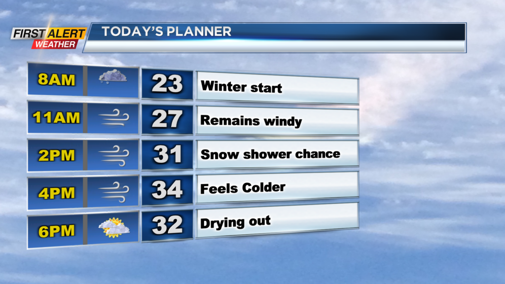
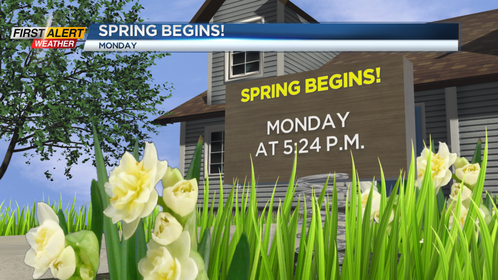
Snow will also have a chance to stick to roads as we remain below freezing, but no big impacts are expected. The best chance for occasional snow showers will be southwest of Rochester, and north of the thruway. Even though today will be a Winter day, Spring arrives tomorrow, and it will feel like it.
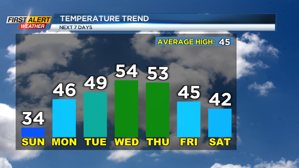
Tomorrow we will remain breezy, but the sun will be shining. Temperatures will also rebound in the afternoon as they make their way into the mid-40s! The warmup does not stop there as temperatures will make their way into the mid and low 50s by Thursday afternoon.
Even with the mild stretch of weather, we are looking unsettled towards the end of the week. A cold front on Thursday will likely bring us widespread rain before another round of unsettled weather rolls in Friday/Saturday.