First Alert Weather: Wintry conditions will remain across Western New York
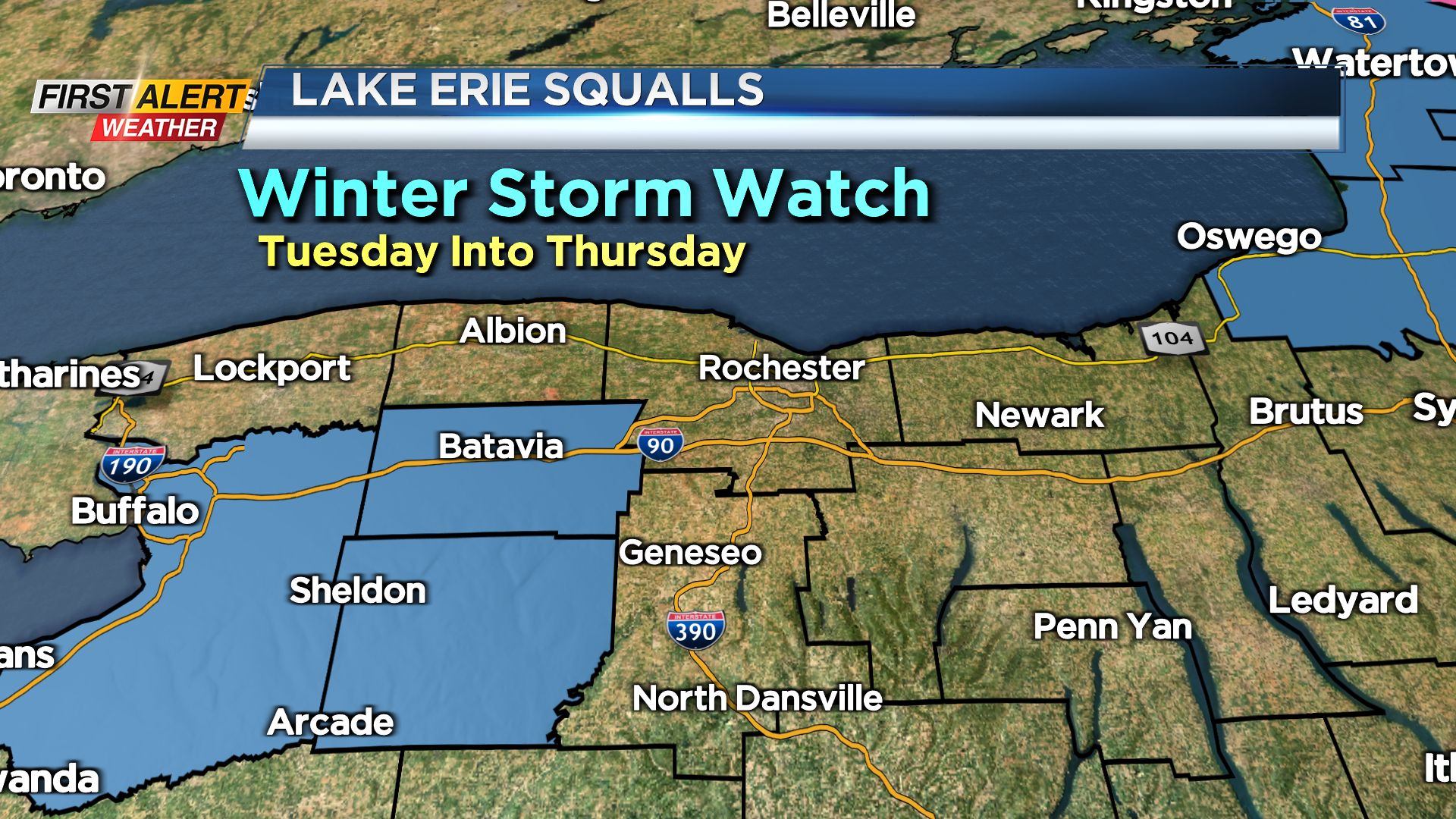
ROCHESTER, N.Y. – Rochester enjoyed some sunshine and lighter winds on Monday, but it will not last. A weak low-pressure system along the east coast will bring a brief period of light snow for the area Tuesday morning, but with minimal accumulation. Then Lake Erie snow squalls will redevelop for communities west of Rochester. Right now, a winter storm watch is in effect for Genesee and Wyoming Counties from Tuesday morning through Thursday.
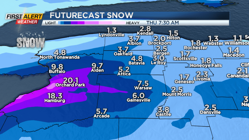
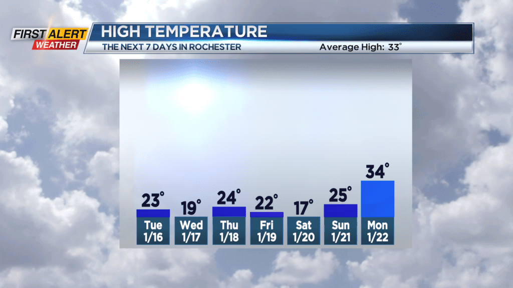
Monday night look for patchy clouds to give way to overcast skies. Area wide light snow will develop towards the early morning. The temperature will fall into the middle teens and then the temperature will begin to rise later Monday night. Tuesday you can expect more light snow with an accumulation near one inch before tapering to flurries by midday. The skies may brighten late in the day. The temperature will rise to near 23 degrees and then fall sharply later in the afternoon. Lake Erie snow squalls will be returning for Tuesday night into Wednesday and Thursday. Portions of Genesse and Wyoming Counties could easily see 10 to 20 inches of snow, but the immediate Rochester area should only measure a minimal amount of snow. News 10NBC First Alert meteorologists will continue to monitor this as the lake squall will change conditions rapidly from time to time and location to location.
Stay tuned to News10NBC First Alert weather for updates on the forecast.