First Alert Weather: Wintry mix, some snow and cold air return
[anvplayer video=”5163093″ station=”998131″]
ROCHESTER, N.Y. If you thought winter was over, you haven’t spent many winters in western New York!
After Wednesday’s record warmth, winter is making a return, starting tonight. Colder air is filtering in from the north. Meanwhile, milder air is still hanging on south of the Thruway. Initially, we’ll see rain showers across the area, but as the air grows colder, some freezing rain and sleet will begin to mix in before eventually changing over to snow showers by Friday morning.


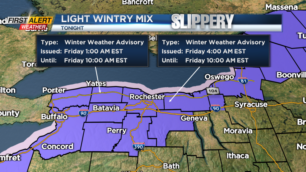
Expect very light icing, with just a light coating for most, with the slickest spots likely north and west of Rochester in northern Monroe and Orleans Counties, where we’ll drop below freezing earliest. Surface temperatures will be in the 20s to start Friday, so any untreated surfaces will be slick from the wintry mix overnight.
Give yourselves just a few extra minutes for the morning commute. Temperatures will hold in the 20s, with a busy breeze, making it feel more like the teens all day. This is a far cry from the mid to upper 60s we enjoyed on Wednesday! The weekend looks pretty good with temperatures in the 40s both days (Sunday will be the slightly milder day) and a mix of clouds and sun, along with dry weather.
We are monitoring a potential winter storm toward the middle to end of next week, but at this point, any kind of weather is on the table. We’ll hone in on some of the finer details this weekend as we get a little closer.