First Alert Weather: Yellow Alert continues for lake effect snow
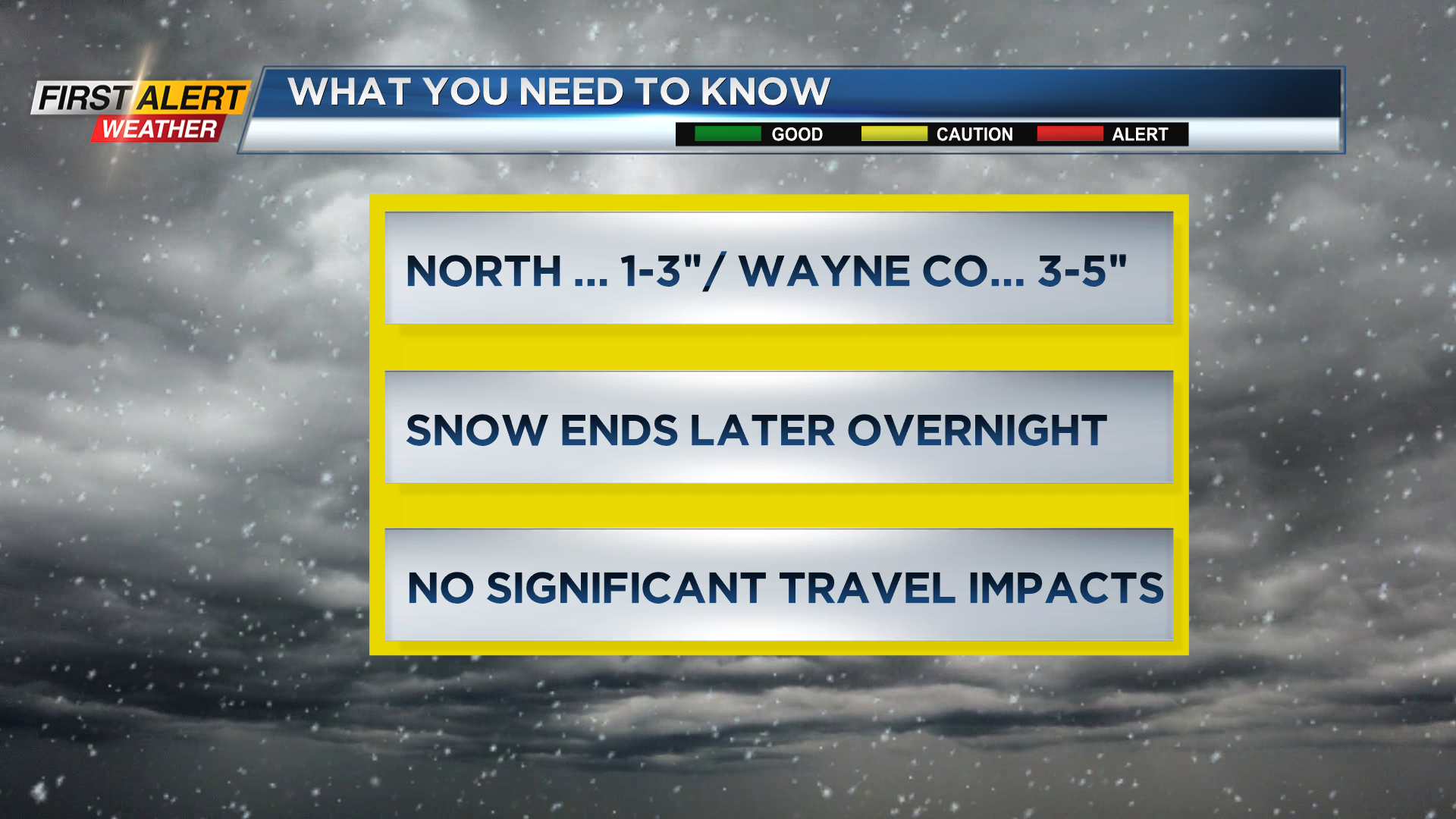
Looking back, seven out of the last eight days have produced measurable snowfall in Rochester. Obviously, today was no exception with accumulating snow for most spots that are located north of the New York State Thruway. The main driving factor for the lake snow has been the bitter cold temperatures, as most of Saturday has only been in the teens with the wind chill near zero. The Lake Ontario snow is likely to continue off and on through this evening and then slowly taper to flurries well after midnight. A huge area of high pressure is the large-scale weather system that is slowly moving across the eastern half of the country. As that system moves east in the coming days, a more southwesterly wind flow will develop across the great lakes. This will bring noticeably milder weather to Western New York for the coming week.
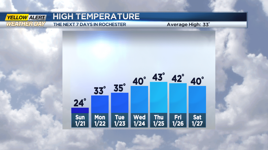
Tonight, the News 10NBC First Alert weather team will keep a Yellow Alert in effect – at least before midnight. Lake Ontario snow will be off and on with additional accumulation in the range of 1 to 3 inches for any community north of the Thruway. The lake snow will likely be more persistent east of Rochester with portions of Wayne County possibly seeing another three to five inches. The winds will slowly diminish with the low temperature near 12 degrees. Sunday morning there will likely be some lingering snow showers or flurries, especially over Wayne County. However, most of the snow will have ended during the day with a few breaks of sunshine later in the afternoon. The high temperature will be in the low to middle 20s. Monday will bring a mix of clouds and sun with the high temperature in the lower 30s.
The remainder of the week appears to free of any significant winter weather. In fact, it will be mild enough for passing rain showers and temperatures rising into the 40s.
Stay tuned to News10NBC First Alert Weather for updates on the forecast.