First Alert Weather: Yellow Alert continues for Western New York this evening
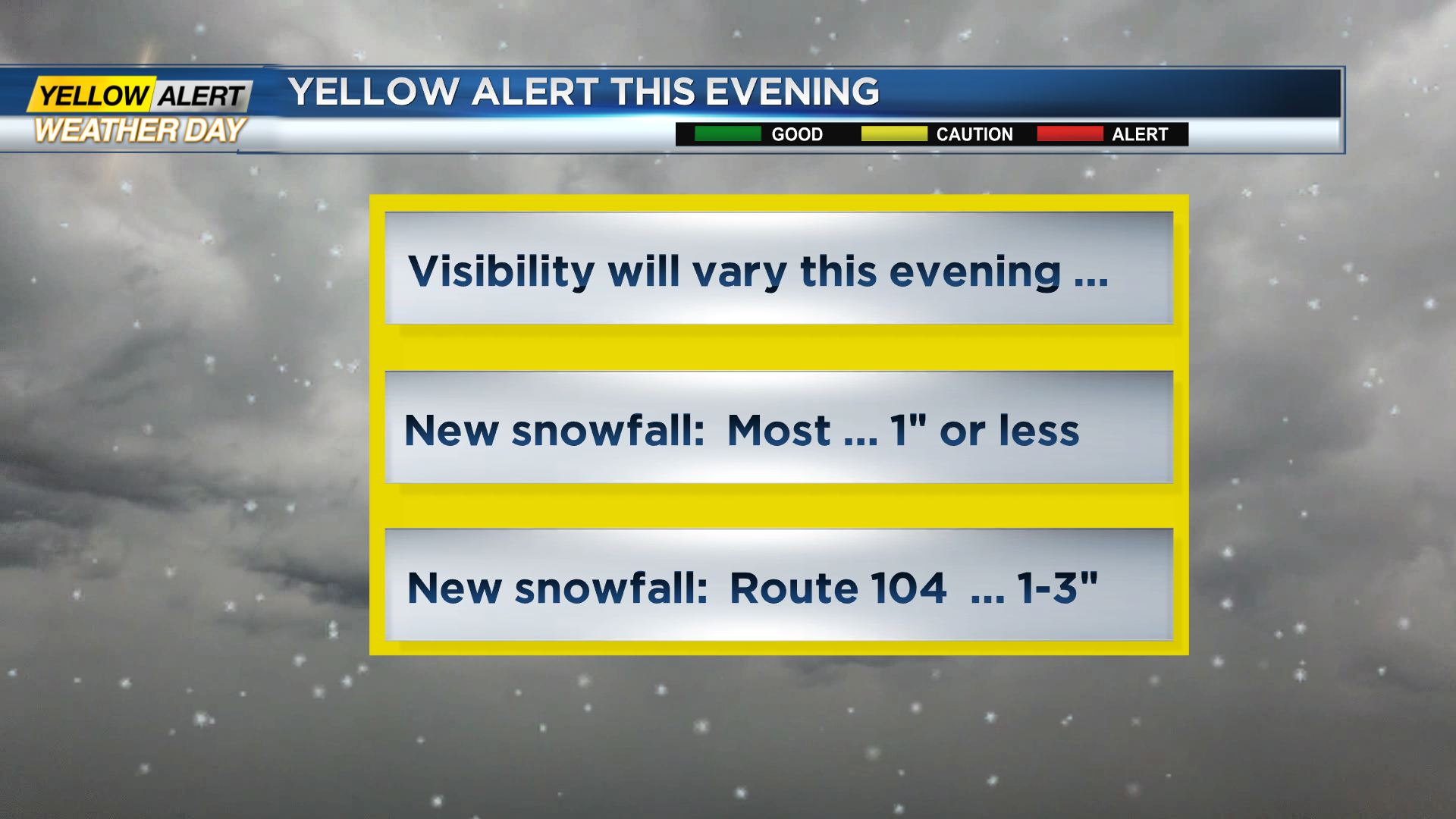
ROCHESTER, N.Y. – The first real snowfall of the season is a nuisance for some, but more of a problem for others. Overall, this will be a relatively small amount of snow for most of the immediate Rochester area, but lake effect squalls can vary significantly from location to location. These bands of snow will move and migrate across the area. If you are traveling Tuesday evening, please be advised that visibility will vary significantly from one location to another, especially if you live north of the New York State Thruway. However, the News 10NBC First Alert meteorologists expect this lake snow to taper off around midnight.
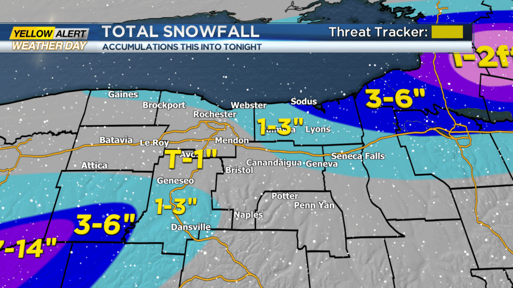
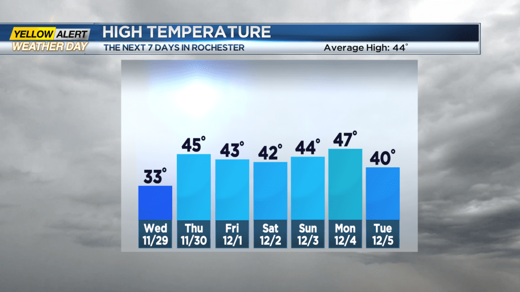
Tuesday night, look for occasional lake snow with most areas seeing an inch or less of new snow, but along Route 104, especially into Wayne County, an additional 2 to 4 inches is expected with the eastern portions of Wayne County seeing as much a 4 to 6 inches. The lake snow should end near midnight. The low temperature will be in the lower 20s. Wednesday mostly cloudy skies with passing flurries or a snow shower. Little or no additional accumulation is expected. The high temperature will be in the lower 30s. Thursday will become partly sunny and not as cold. The mercury will rise into the middle 40s.
Stay tuned to New 10NBC First Alert weather for updates on the forecast.