First Alert Weather: Yellow Alert for moderate snowfall areawide on Tuesday
[anvplayer video=”5167203″ station=”998131″]
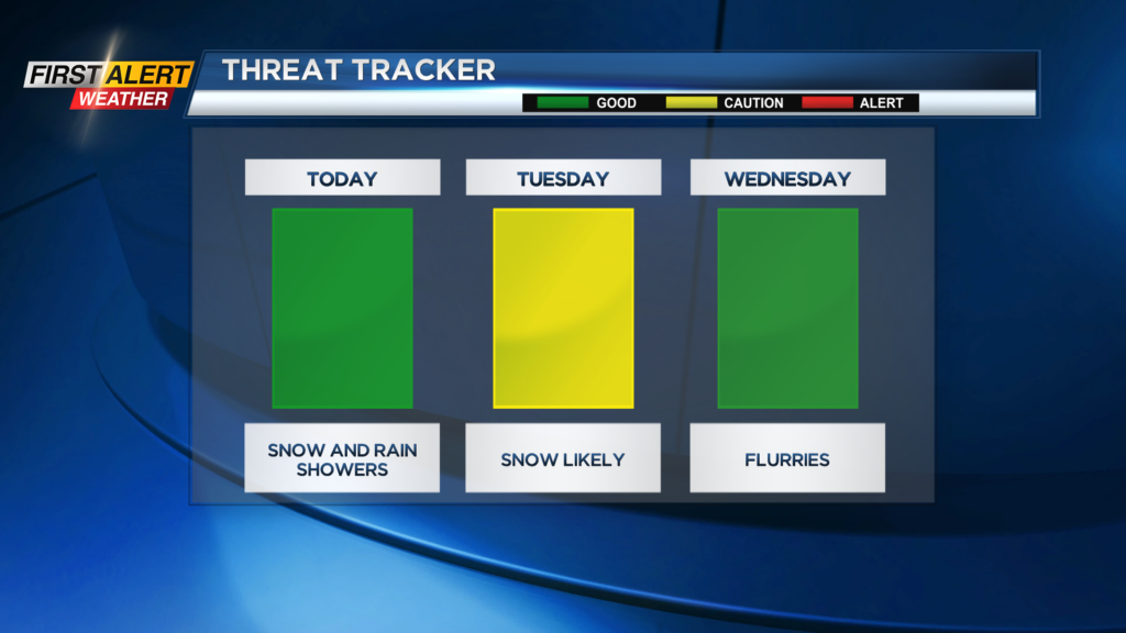
ROCHESTER, N.Y. — After a cloudy and damp day to start the week with snow and rain showers a large storm will develop on Tuesday in New England.
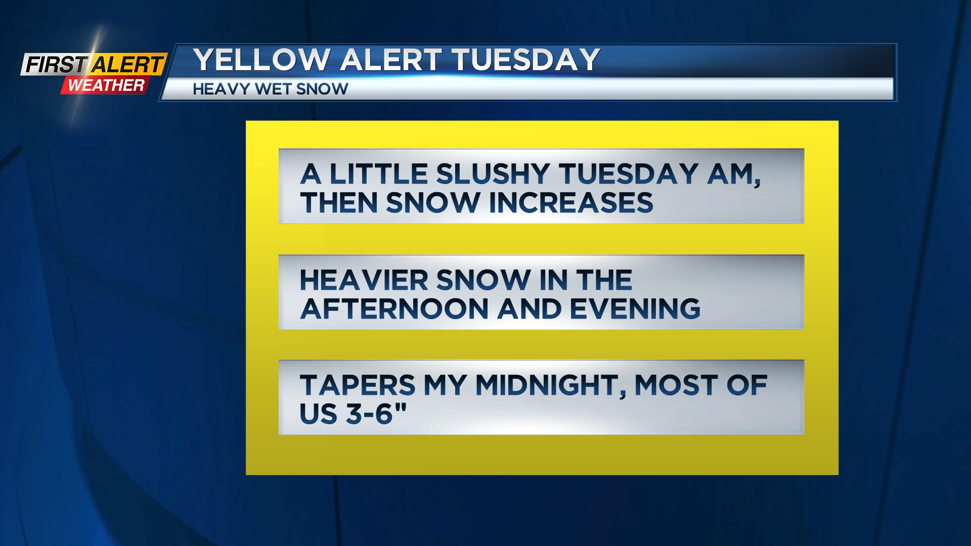
The heaviest snow and wind will stay well to our east but we will be impacted by winter weather. Threat Tracker is yellow as a heads up to be prepared for deteriorating conditions throughout the day on Tuesday into Tuesday night.
There will be a minor impact on the morning commute with just some light snow at times first thing in the morning.
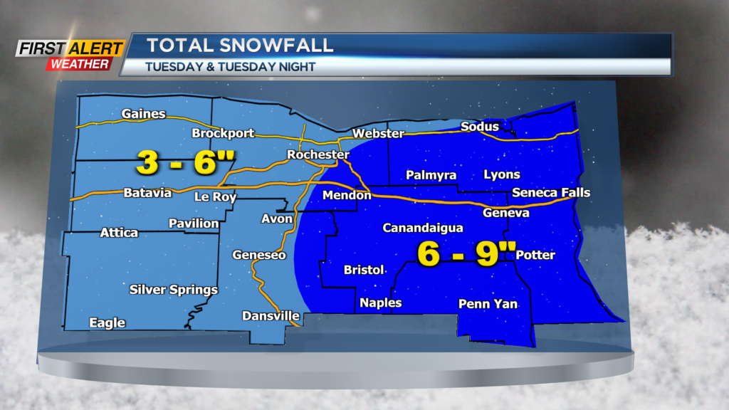
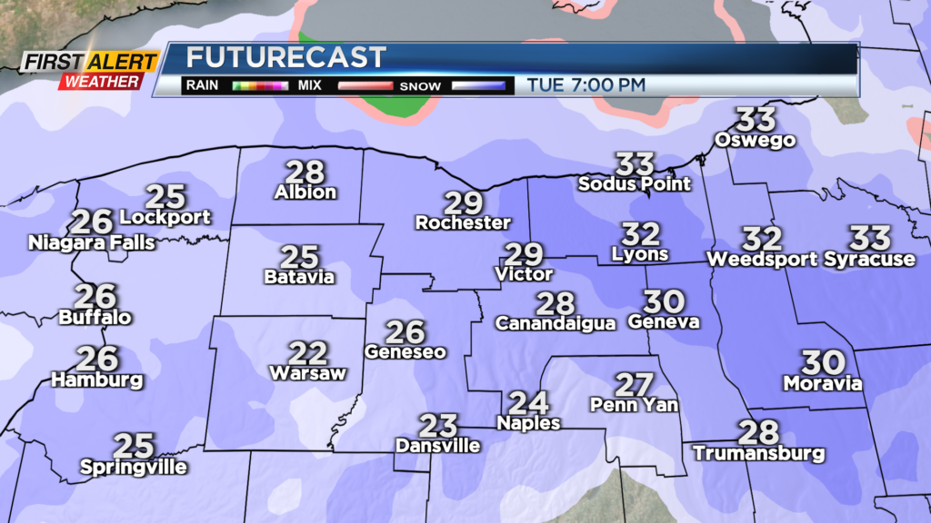
Snow will be on the increase into Tuesday afternoon with issues expected for the evening commute. Plan on 2-4″ on the ground by 6 p.m. with a few more inches tomorrow night bringing totals for most of us into the 3-6″ range.
Areas east of Rochester may get into a period of heavier snow for a couple of hours and higher totals are possible over 6″ for the Finger Lakes region. Snow will wind down late Tuesday night and just flurries are expected on Wednesday.
Stay tuned to News10NBC for the latest on the timing and any adjustments to snow totals that may be needed if storm track changes.
______________
Download the WHEC First Alert Weather app to stay up to date while on the go.
Watch the latest full forecast online.