First Alert Weather: Yellow Alert for some late-week snow/mix
[anvplayer video=”5152340″ station=”998131″]
ROCHESTER, N.Y. We’ve been tracking the potential for wintry weather for the end of this week, and that remains on track.
There are still questions regarding timing and how much of what falls, but we’re fairly confident we’ll get some wintry mix (rain, snow, ice), changing over to a period of snow later Thursday. This may impact the Thursday evening commute.
Snow may continue into the Friday morning commute, potentially creating slick roads then, too. At this point, this storm won’t be a “big” one by western New York standards, but it’ll likely be our biggest accumulating snow so far this season.
The wintry mix may also add to issues on roads. A Yellow Alert is a “heads up” to keep an eye on a potentially changing forecast.
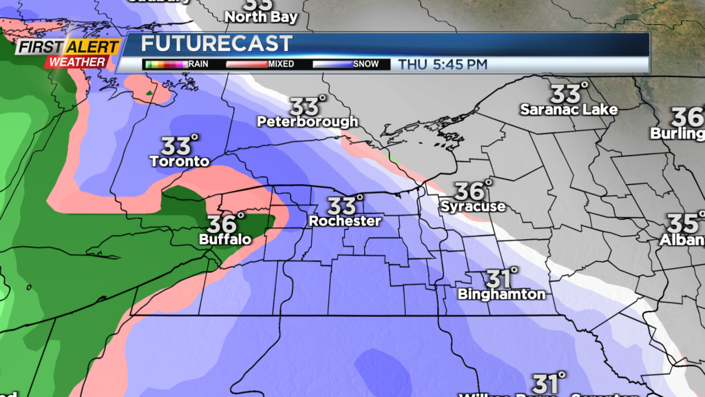
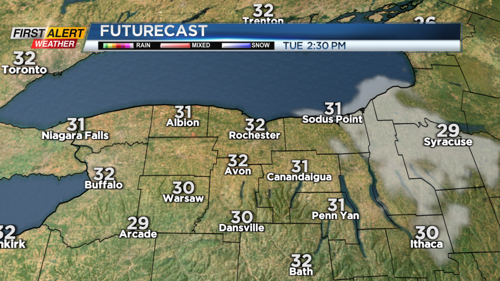
Before that wintry weather arrives later this week, we’ll enjoy quiet but chilly weather with some sunshine on Tuesday and Wednesday and highs in the lower 30s. That wintry mix is expected to develop Thursday afternoon, with snow tapering on Friday.
The upcoming weekend will be a chillier one with highs in the lower 30s once again and some lake effect snow, mainly off Lake Erie. The early outlook for the Bills game in Orchard Park on Saturday will be a chilly one, with the potential for some lake effect snow at Highmark Stadium.
First Alert Meteorologist Stacey Pensgen has your Monday forecast.
Stay tuned as we update the end-of-the-week forecast and Bills game day forecast!