Yellow Alert Weather: Some snow locally, crippling snow near Buffalo
[anvplayer video=”5148329″ station=”998131″]
ROCHESTER, N.Y. — The big lake effect event we’ve been talking about for days has arrived.
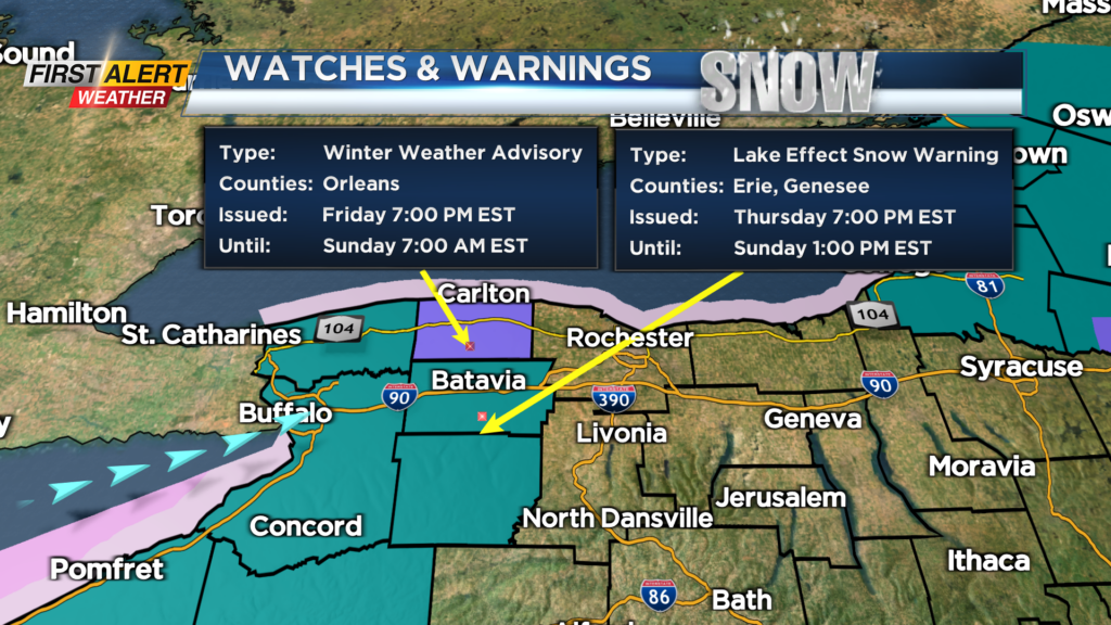
The main band develops this evening with a burst of area-wide snow (generally less than 1″ of snow accumulation), then the main Lake Erie lake band becomes established overnight, focusing in on a corridor from Buffalo and the south towns to the Thruway and southern Genesee County, and much of Wyoming County.
Travel west will become slow this evening, difficult overnight, and near impossible near Buffalo. This main band will continue to pummel the Buffalo area and south towns through Friday. The wind will be strong enough to carry some of that snow into central and northern Livingston County, in addition to the Finger Lakes at times.
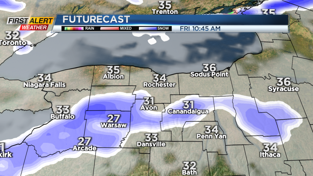
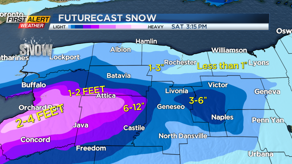
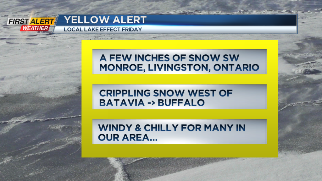
This is where we may see a few inches of snow during the day Friday. This main band will begin to shift northward Friday night, establishing itself over Buffalo, Niagara Falls and western Orleans County on Saturday. The Rochester region should actually see a fair amount of sun but feel the chill on Saturday with limited flakes.
The lake band will drop south and become much more unorganized on Sunday with another wind shift. This will spread the snow out much more but lessen the intensity of the snow. This also means we may see some passing snow showers and bursts of snow for the Bills game, but the heaviest snow will be done by then. Outside of any snow showers, Sunday will be a cold and windy day!
Looking ahead to next week – we’ll see quiet weather leading up to Thanksgiving, which is great for travel! Thanksgiving Day itself is trending drier, but a little cooler. Post-Thanksgiving travel may be an issue next weekend, as we may be eyeing a potential system. A lot of details still have to be ironed out, so we’ll keep you posted if anything develops.