Yellow Alert Weather: Bitter cold and lake effect snow on Monday through Wednesday
ROCHESTER, N.Y. – It could be the coldest air in more than several years for Western New York and it will be arriving Monday, Tuesday, and Wednesday.
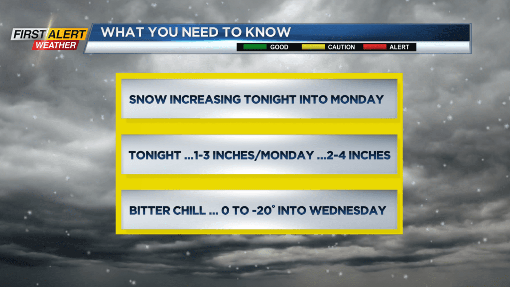
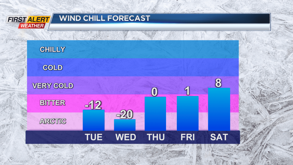
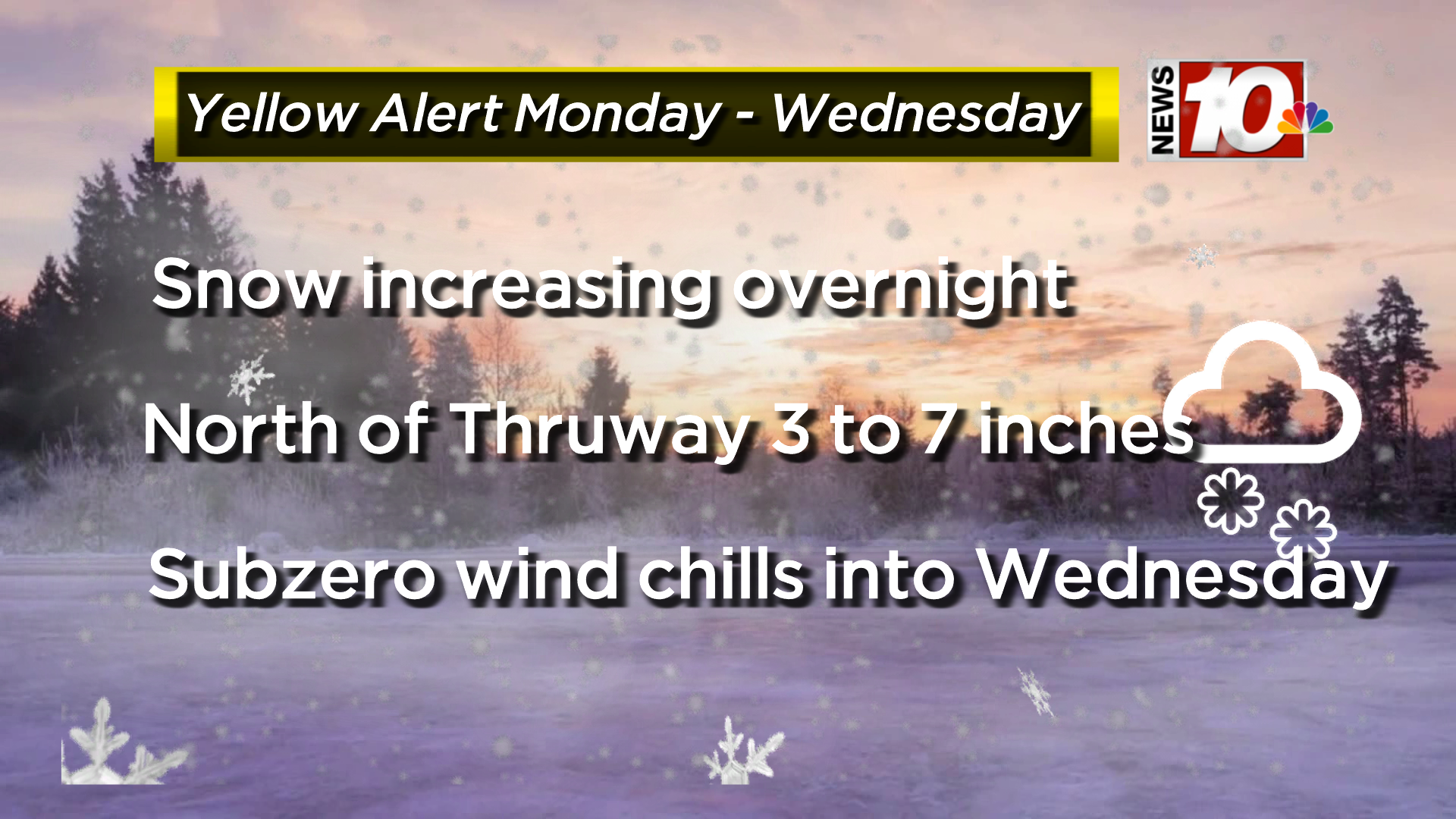
At times, the wind chill factor will be running from zero to -20 degrees. In addition, Lake Ontario snow will be on the increase overnight. Initially, snowfall after midnight will accumulate to just one to three inches by Monday morning. However, lake snow will continue through midday on Monday with another two to four inches of new snowfall.
This would bring snow totals to between three and seven inches for communities north of the New York State Thruway. Also, it is possible that snowfall amounts could be even higher for locations along the Route 104 corridor with amounts exceeding eight inches lakeside. Travel will likely be slow and difficult with poor visibility for Monday morning. This lake snow should begin to taper off to light snow and flurries by later Monday afternoon.
Rochesterians should be prepared for harsh weather conditions for the next three days with the potential for hypothermia or frostbite unless dressed correctly. As a result, the News10NBC First Alert meteorologists have issued a Yellow Alert for Monday through Wednesday. The weather should begin to moderate by Thursday with the temperature eventually rising to above freezing by the end of next weekend.
Stay tuned to News 10NBC First Alert weather for updates on the forecast.