First Alert Weather: Yellow Alert remains up for bitter air and dangerous wind chills
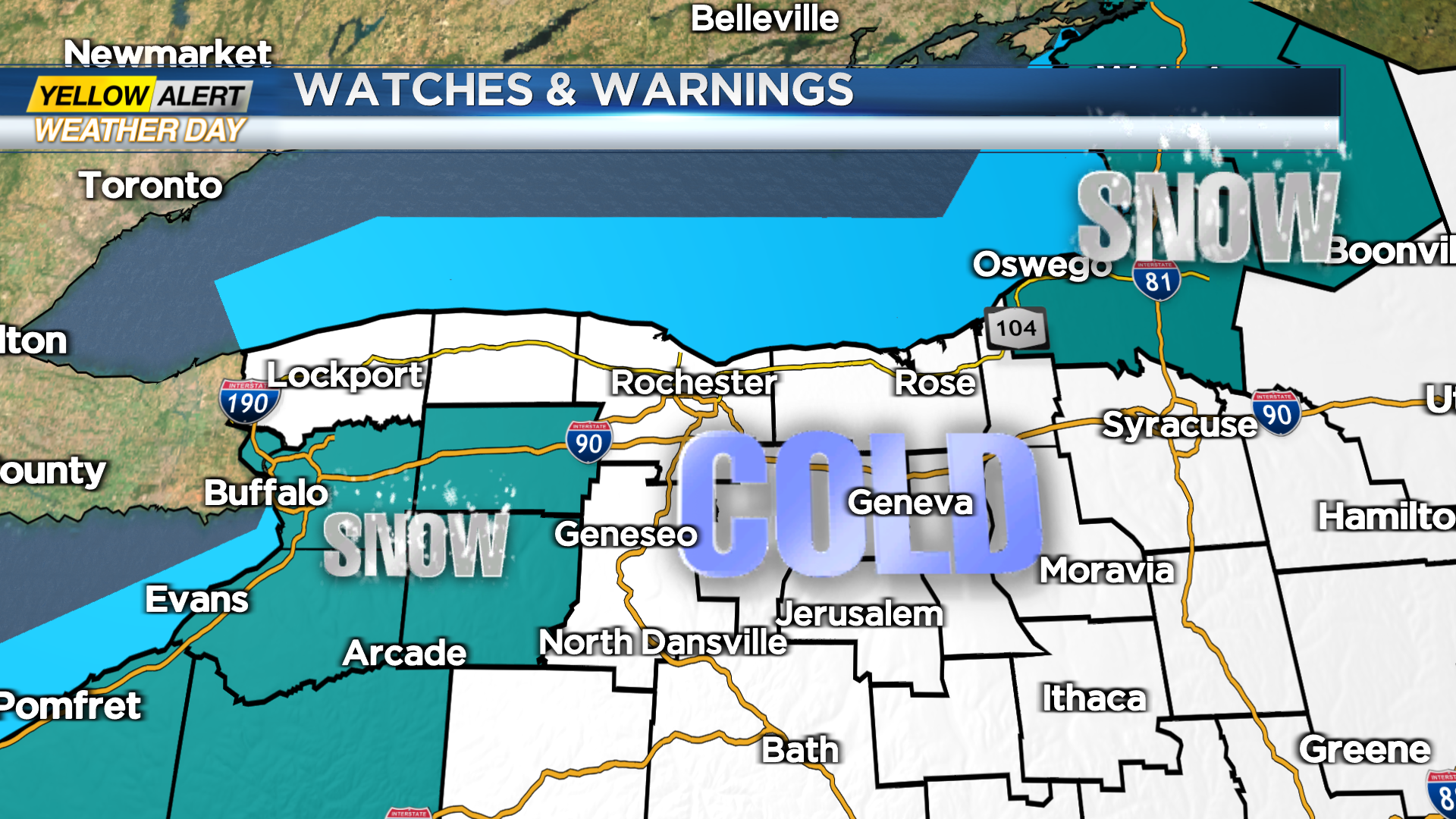
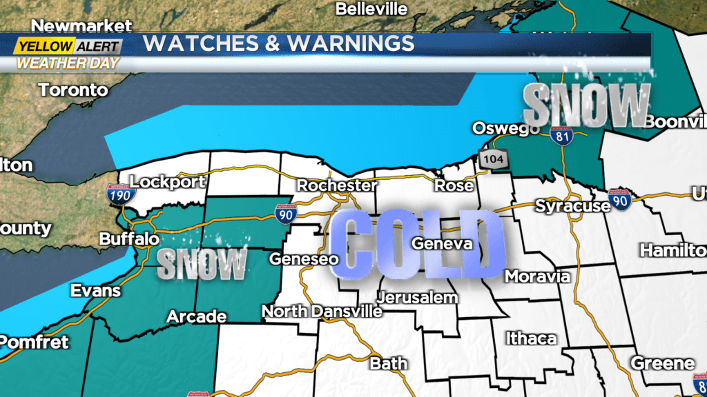
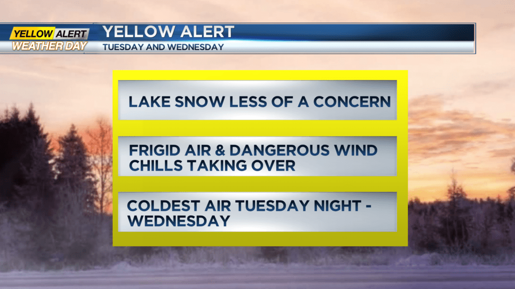
ROCHESTER, N.Y. — A Yellow Alert remains up through Wednesday for bitterly cold air and dangerous wind chills at times. Much of the Rochester region picked up accumulating snow from Lake Ontario Sunday night into Monday morning, but the cold will be the main focus through mid-week.
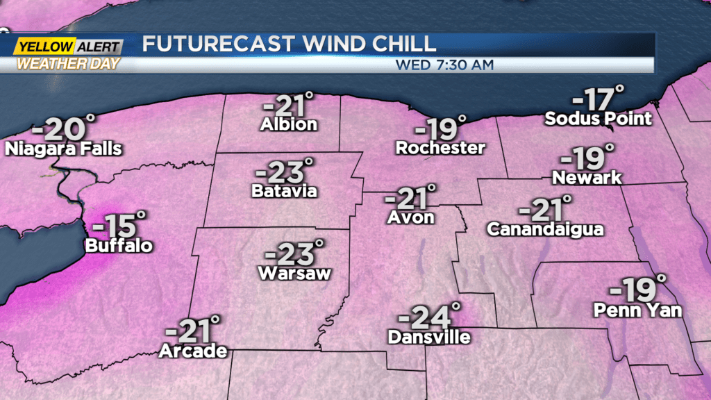
Chilly air will turn even colder on Tuesday and Wednesday, with daytime high temperatures peaking in the lower teens and upper single digits, and bottoming out in the lower single digits and sub-zero readings Tuesday and Wednesday mornings. Factor in a gusty wind, it’ll drop wind chill values to -10 to -20 degrees at times. This is how it’ll feel on your bare skin. So it’ll be important to cover exposed skin if you need to be outside for more than five to 10 minutes, as frostbite can occur quickly. It is also a good idea to limit the amount of time any pets are outdoors, even if they seem to love the cold weather. Temperatures will begin to moderate a bit by Thursday, climbing back into the 20s and stay there the rest of the week and into the weekend.
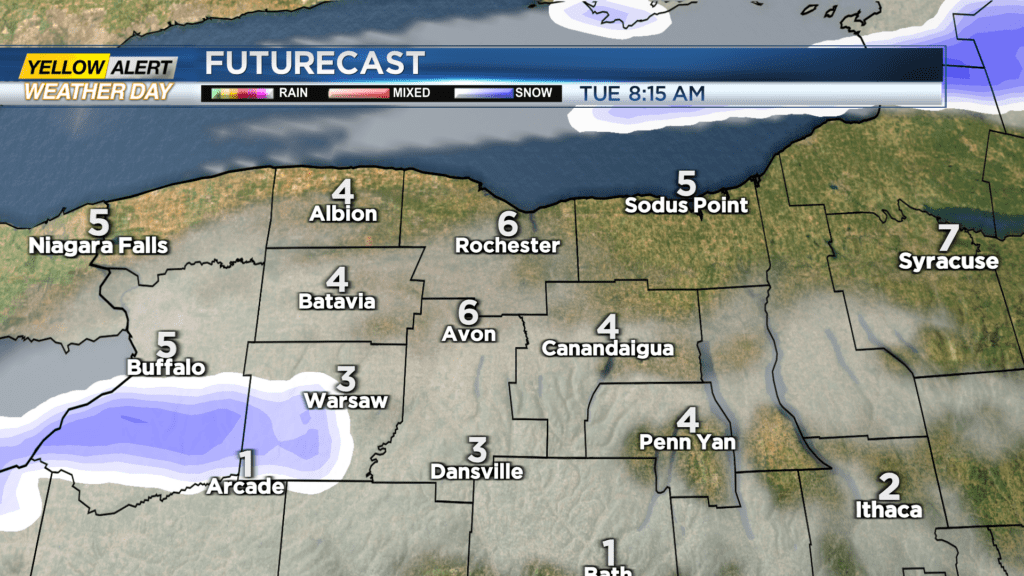
As far as snowfall goes, we’ll see some Lake Erie snow impacting Wyoming and southern Genesee Counties, and drifting into Livingston County at times Monday night and Tuesday. Most appreciable accumulation will be confined to Wyoming and Genesee Counties, but a few inches of fresh fluff will be possible south of Rochester. Wednesday will feature some nice sunshine, though temperatures will remain bitter. A few snow showers and flurries are possible on Thursday with a weak disturbance passing by.
Once we get passed Wednesday, our weather will quiet down and “warm” up nicely.