First Alert Weather: Yellow Alert: Strong to severe thunderstorms Thursday evening
[anvplayer video=”5185920″ station=”998131″]
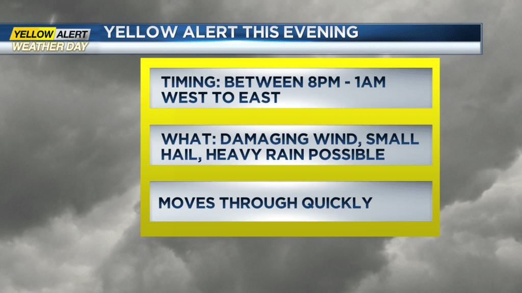
ROCHESTER, N.Y. — A Yellow Alert is up for the potential for strong to severe thunderstorms between 8 p.m. and midnight across our area.
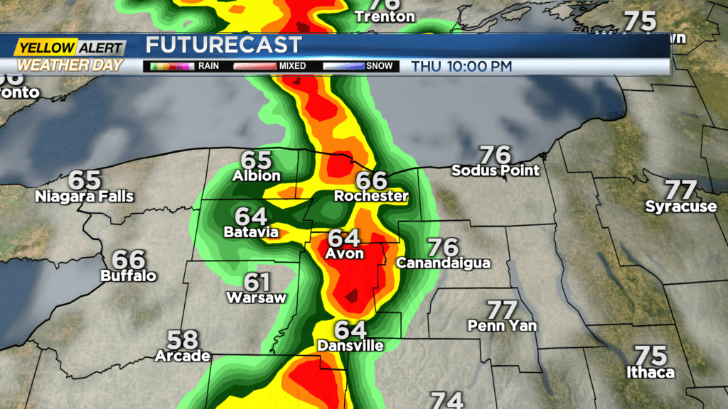
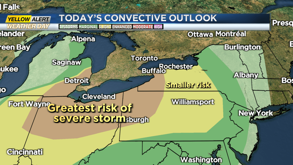
A line of severe weather moving through the eastern Great Lakes that has a history of producing hail and damaging wind continues to track toward western New York. Though the sun will be setting, there will likely be enough instability in the atmosphere to keep the severe threat around as the storms move into western New York.
The main threat for us is isolated damaging wind gusts, small hail and briefly torrential rain. There is the small chance for a brief tornado, especially west and south of Rochester. The storms will move into Buffalo between 7-8 p.m., the Rochester area between 8-10 p.m., and exit the Finger Lakes between midnight and 1 a.m. So, these will be quick hitting, but may pack a punch as they move through. Download the First Alert Weather app to get up to the second severe weather updates as they are issued.
Storms will be long gone by the time you wake up Friday morning, though we’ll still see a few showers or even a thunderstorms, especially east of Rochester. Severe weather isn’t expected on Friday, and our weather quiets down nicely for the weekend.
In fact, we expect mainly dry weather on Saturday, mostly sunny skies on Sunday, and temperatures in the upper 70s and lower 80s both weekend days.