First Alert Weather: Yellow Alert Thursday for potential flooding
[anvplayer video=”5184895″ station=”998131″]
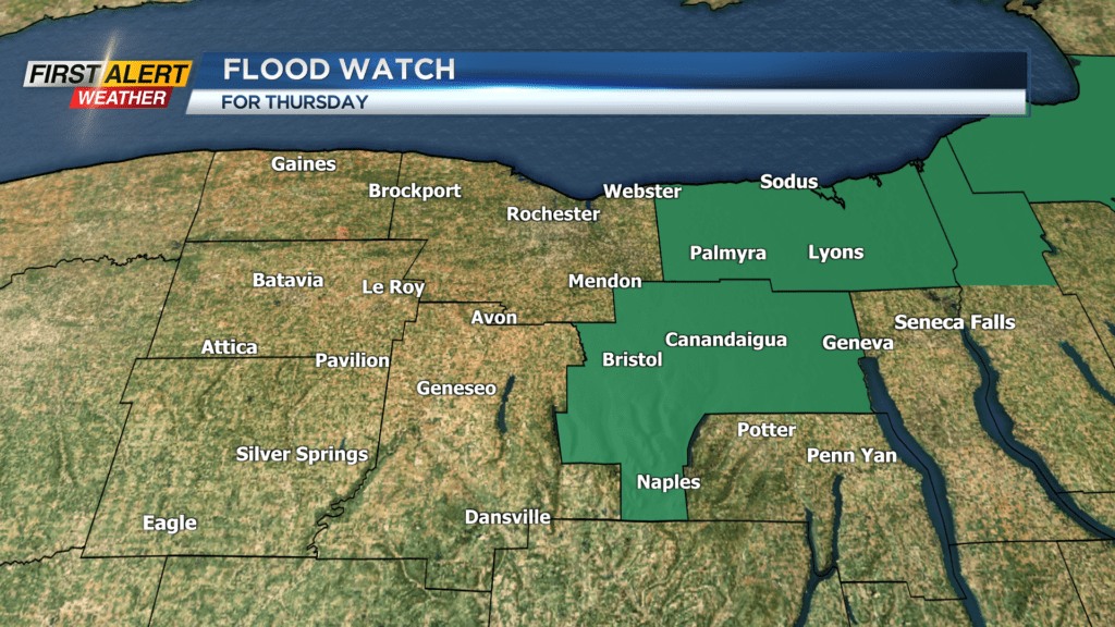
ROCHESTER, N.Y. — The First Alert Weather Team has issued a Yellow Alert for Thursday in regards to more potential flooding, especially east of Rochester. A Flood Watch has been put up for Wayne and Ontario Counties which will go into effect Thursday morning and last until Thursday evening.
Due to the recent rainfall within those counties, and expected showers and thunderstorms Thursday, there is a heightened risk for flash flooding. Clouds will increase late Wednesday evening and give way to showers late Wednesday night and into Thursday morning. This will be round 1 of rain for Thursday. Rain can be heavy at times early before clearing out during the morning commute. Then most of the morning and early afternoon will feature mostly cloudy and dry conditions.
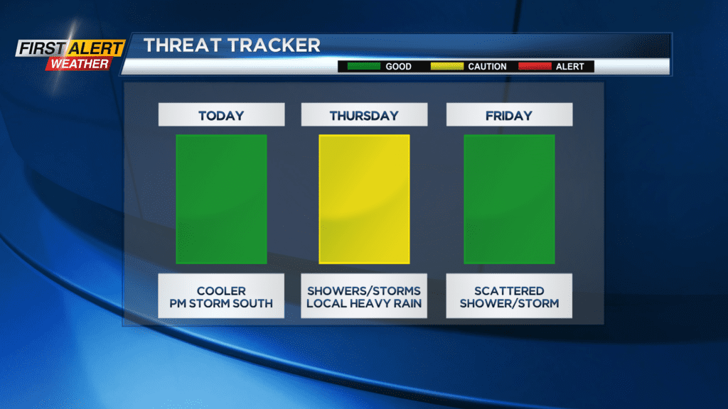
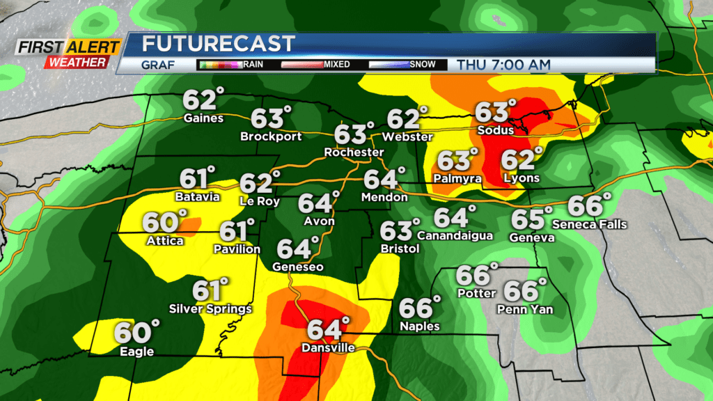
A warm front that lifts through Thursday morning will increase humidity and moisture across our region which will bring an increased threat for locally heavy downpours Thursday afternoon as a cold front rolls through. Not everyone will see a thunderstorm Thursday afternoon, as our best chances for storms will be east of Rochester. Storms will likely begin to pop to our east around two in the afternoon before moving out of the region by seven in the evening.
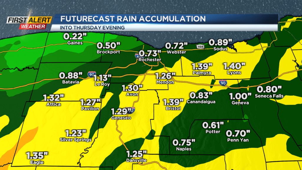
Storms that pop will have ample moisture to work with and could produce rainfall rates over one inch per hour. This means that flash flooding will be of concern, along with pooling and ponding and limited visibility on the roadways. Rainfall totals for areas east of Rochester could approach two inches for localized locations by Thursday night.