First Alert Weather: Minor snow early Thursday, bigger storm for the Northeast this weekend
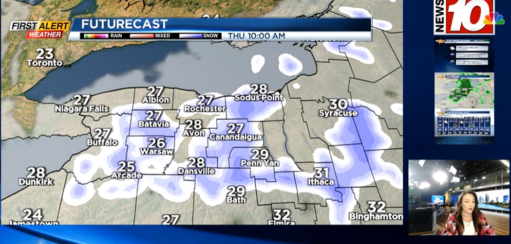
ROCHESTER, N.Y. – Quiet weather will persist into Wednesday with a mostly cloudy sky and nothing more than some flurries west of Rochester, but no accumulation expected. This will begin to change Wednesday night with the passage of a cold front. The front itself will bring a few hours of snow showers, followed by a few hours of lake snow showers into Thursday morning. In total, expect a coating to an inch or two of snow. We may see a few slick spots during the Thursday morning commute, but widespread issues aren’t expected. We should see some sunshine returning Thursday afternoon, but it’ll be a chillier day with a brisk breeze and temperatures falling back into the 20s. Friday will be dry with some sun ahead of our next system that we’re tracking.
The weekend will likely bring significant accumulating snow to some cities in the Northeast, possibly some accumulation in the Rochester area, depending on the track of the low. A Nor’easter will be developing, and tracking right along the Mid-Atlantic coast. The best chance of more significant accumulating snow will likely be in the interior Finger Lakes and downstate New York, with the least amount of snow west of Rochester toward Buffalo. At this point, we expect at least some light snow in and around Rochester, and depending on how far west the snow makes it, parts of the area could be doing some shoveling or even plowing. If the track of the low tracks just a little further west, we may see more of an impact locally. The timing would bring light snow on Saturday evening, with the steadiest snow falling Saturday night, and beginning to taper Sunday morning. We’re monitoring the potential for a Yellow Alert, and we’ll of course keep you posted on any changes to this forecast.