Gusty winds likely into Sunday morning
[anvplayer video=”5169475″ station=”998131″]
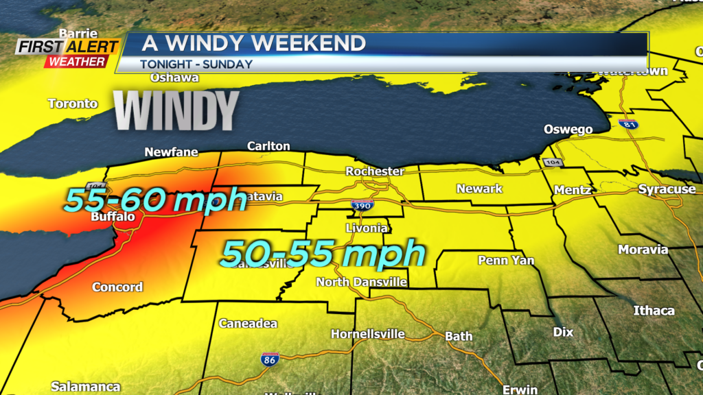
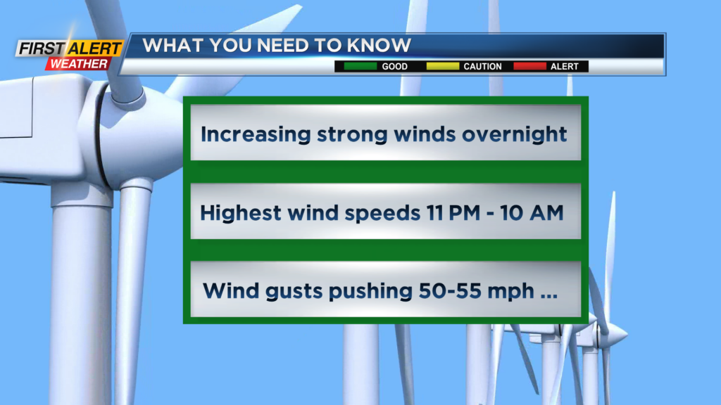
ROCHESTER, N.Y. – A strong low-pressure system is currently moving across the central great lakes and will bring some rapid changes in our weather. An occluded front will move across Western New York during the overnight and, as a result, we will feel a quick drop to the temperature for tonight. However, the greatest impact will be strong winds, especially west of Rochester. Right now, we expect the wind speeds to stay below the criteria for significant problems, but some isolated power outages are possible for the next 12 to 24 hours. Overall, weather conditions will improve quickly for Sunday.
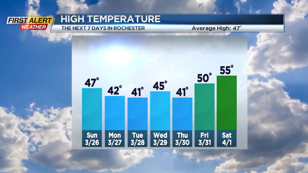
On Saturday night, rain showers will end, as a few wet snow showers arrive. The temperature will fall into the middle 30s. Winds will gust to between 50 and 55 mph with the highest wind speeds between 10 p.m. and 10 a.m. Sunday. Then Sunday the winds will diminish throughout the day. Skies will become partly to mostly sunny, especially by the afternoon. The high temperature will be in the middle to upper 40s. Monday will become cloudy with a weak disturbance bringing a few rain and wet snow showers for the afternoon. The high temperature will be near 42 degrees. Look for some wet snow showers Monday night with maybe a small accumulation by morning. The low temperature will be near 30 degrees. On Tuesday morning flurries come to an end, with skies brightening for the afternoon. The high temperature will be within a few degrees of 40.
Stay tuned to News 10NBC First Alert weather for updates on the forecast.