Rapid changes in Our weather expected by mid-week
[anvplayer video=”5150115″ station=”998131″]
ROCHESTER, N.Y. – As a high pressure system builds across the area a slow improvement in our weather is expected over the next 48 hours. This improvement will come in the form of partial clearing and milder temperatures. However, by mid-week a fast moving storm and an associated cold front will cross the Great Lakes and produce some rapid changes by Wednesday into Thursday.
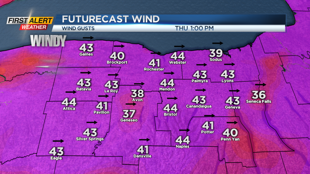
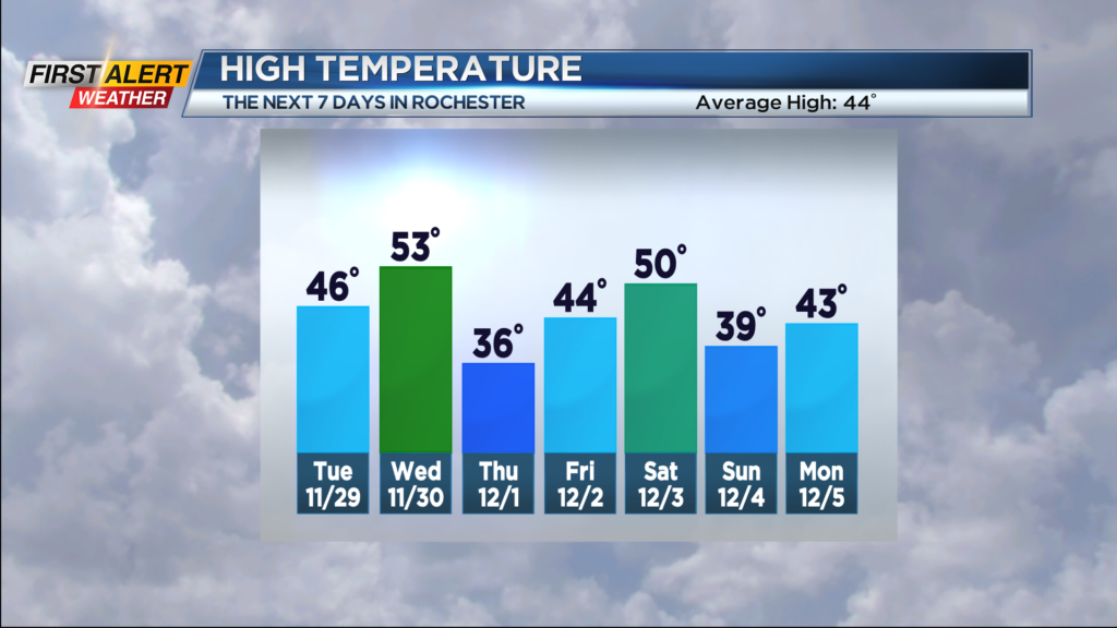
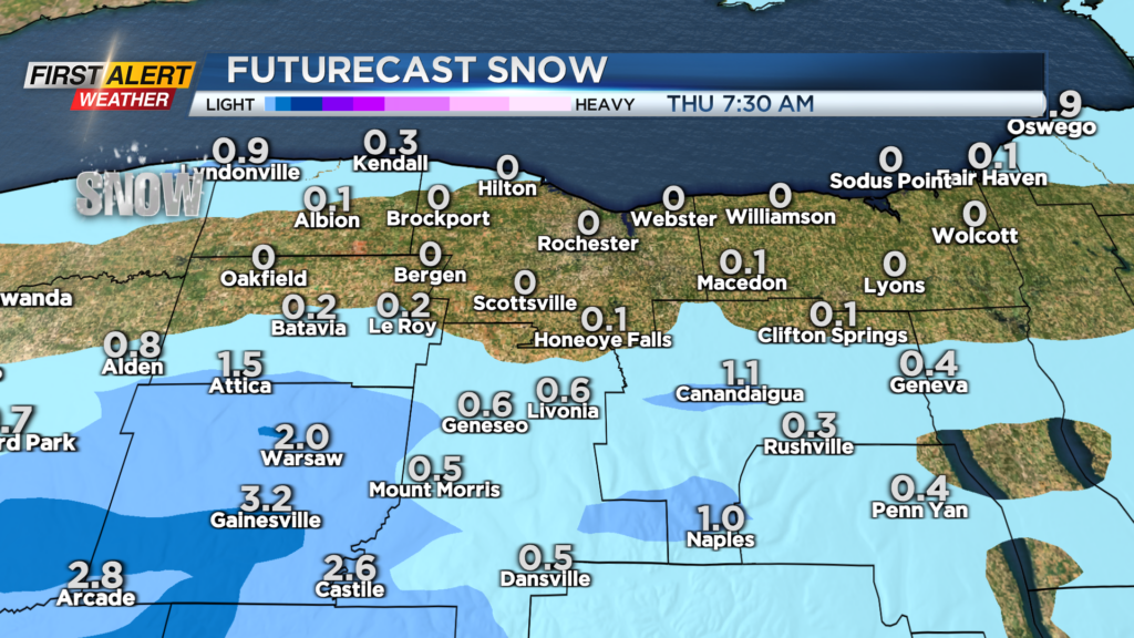
Tonight look for partly to mostly cloudy skies with a low temperature near 30 degrees. Tuesday should get better with a mix of clouds and sunshine. It will be seasonably cool with the high temperature in the middle 40s. Wednesday we will find a few rain showers and it turns mild with the high temperature in the lower 50s. However a strong cold front will pass Western New York during the afternoon and it will turn sharply colder by the evening. This rapid change in the temperature and atmospheric pressure will increase the winds. Wind speeds by Wednesday evening and early Thursday will exceed 45 miles per hour at times. As the temperature drops the rain showers will change to snow showers. Little or no accumulation is expected in Rochester, but portions of Wyoming County may see 1 to 3 inches by Thursday morning. The strong winds should diminish Thursday afternoon, but the temperature will remain in the middle 30s. At this point, the threat tracker shows alerts in effect, but the News 10NBC First Alert Meteorologists will continue to watch the potential for strong winds heading into the middle of the week.
Stay tuned to News 10NBC First Alert for updates on the forecast.