Red Alert Weather: Damaging wind gusts, bitter cold and local lake snows
[anvplayer video=”5154289″ station=”998131″]
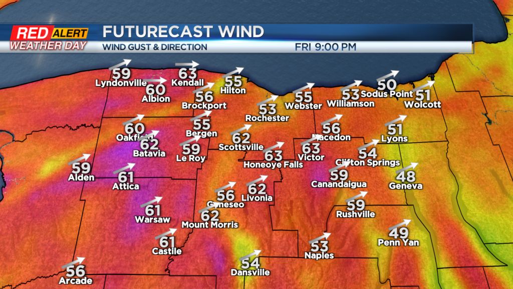
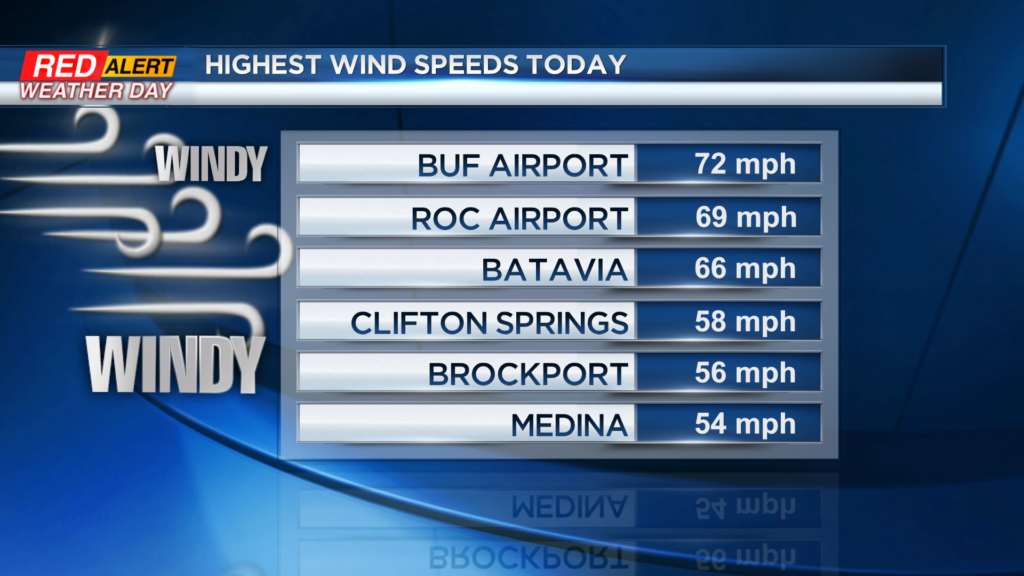
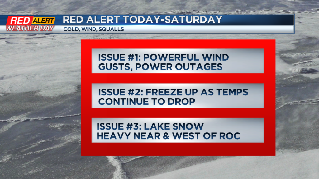
ROCHESTER, N.Y. — The Arctic front has moved through the region on Friday, bringing a round of damaging wind gusts 50-70mph with a peak gust at the ROC Airport so far to 69mph.
Strong winds will continue into the afternoon and night with gusts 55-65mph through midnight. After midnight the strongest of the winds will subside but it will still be very gusty Saturday with winds 40-50mph.
Temperatures have begun to fall fast and will end up in the single digits and teens later Friday into the night with a wind chill well below zero.
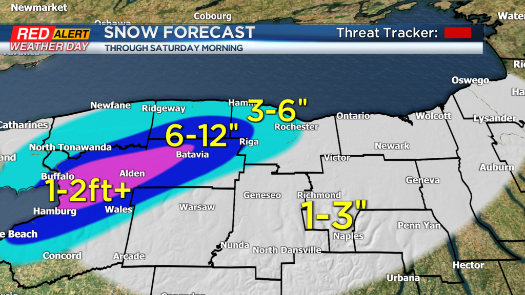
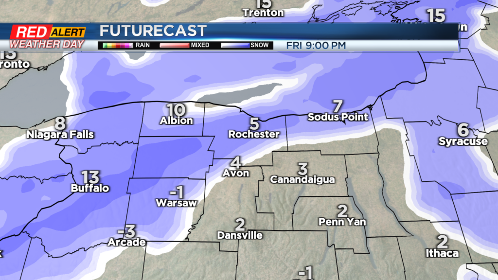
Watch for icy spots on roads, sidewalks and driveways. The lake effect snow will ramp up Friday night with locally heavy amounts west of Rochester with blizzard conditions.
Snow amounts will vary across the region from an inch or so for most to over 6″ in parts of the westside to over a foot of snow in parts of Orleans and Genesee Counties with several feet of snow near Buffalo.
Stay tuned to News10NBC for the latest on the wind and snow into Christmas Eve.
—————————————
Download the WHEC First Alert Weather app to stay up to date while on the go.
Watch the latest full forecast at whec.com/weather.