The battle between winter and spring continues later this week
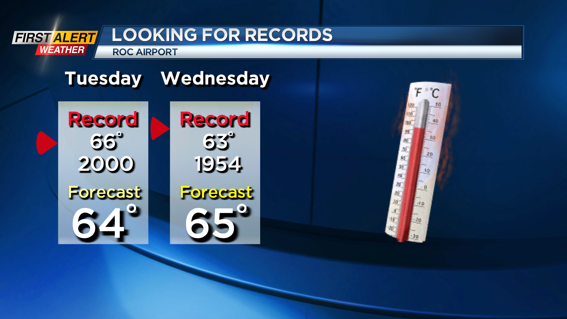
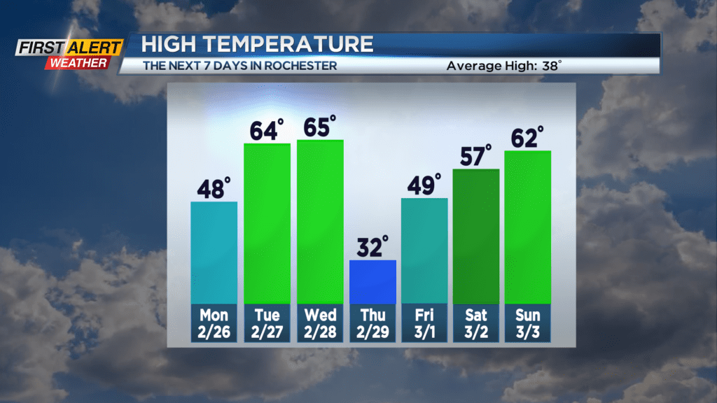
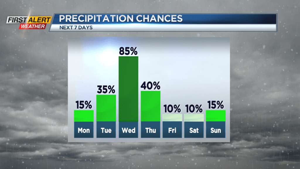
ROCHESTER, N.Y. – A weak cold front will cross Western New York on Monday. However, outside of a just few late-night showers for Sunday night, this will have little impact on Rochester. Then a high-pressure system will arrive and with a more southerly wind for Tuesday. This will bring more spring-like weather pattern for the middle of the week. Depending on the arrival time of any rain showers, temperatures will warm into the 60s. These high temperatures could push to near record high readings for Tuesday and Wednesday.
Sunnday night, look for cloudy skies with a spotty shower after midnight. The low temperature will be in the middle 30s. Monday any patchy morning clouds will give way to mostly sunny skies. It will be a pleasant February day with the high temperature in the upper 40s. Tuesday will feature partial sunshine for the morning with the chance of a rain shower by the afternoon. It will feel more like late April with readings in the lower 60s (the record high temperature is 66 degrees set in 2000). The warmth will continue into Wednesday morning with temperature near the record of 63 degrees (set back in 1954). However, occasional rain showers will be likely through the day with the temperature falling rapidly by Wednesday night. A flash freeze is possible Wednesday night as the temperature will plummet into the 20s.
Stay tuned to News 10NBC First Alert weather for updates on the forecast.