First Alert Forecast: The heaviest rain continues to the east of Genesee Valley
[anvplayer video=”5174782″ station=”998131″]
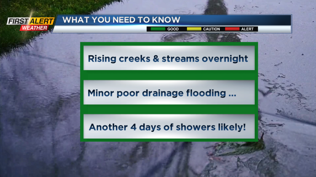
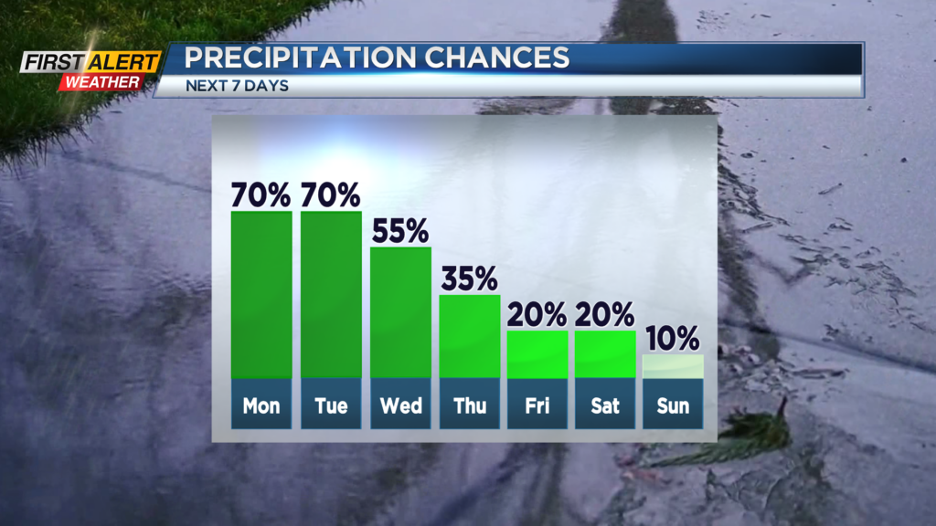
ROCHESTER, N.Y. – A “conveyor belt” of moisture has been pushing from south to north most of the day. The heaviest and steadiest rain has been located from the Genesee Valley east into the Finger Lakes. In this area, rainfall amounts are now approaching 1 inch and will likely near 1.5 inches (or more) before tapering off near midnight. No doubt local creeks and streams will continue to rise, but are expected to stay within their banks for the foreseeable future. However, ponding on roads and localized poor drainage flooding can be expected. Unfortunately, this is a very slow-moving weather pattern and as a result, significantly drier weather will not arrive until the end of the week.
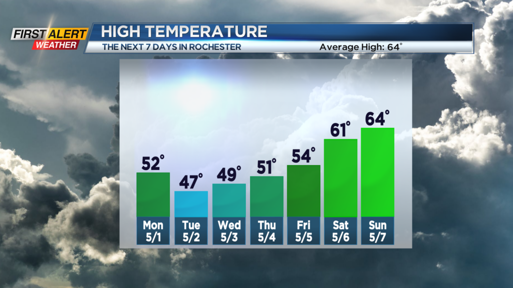
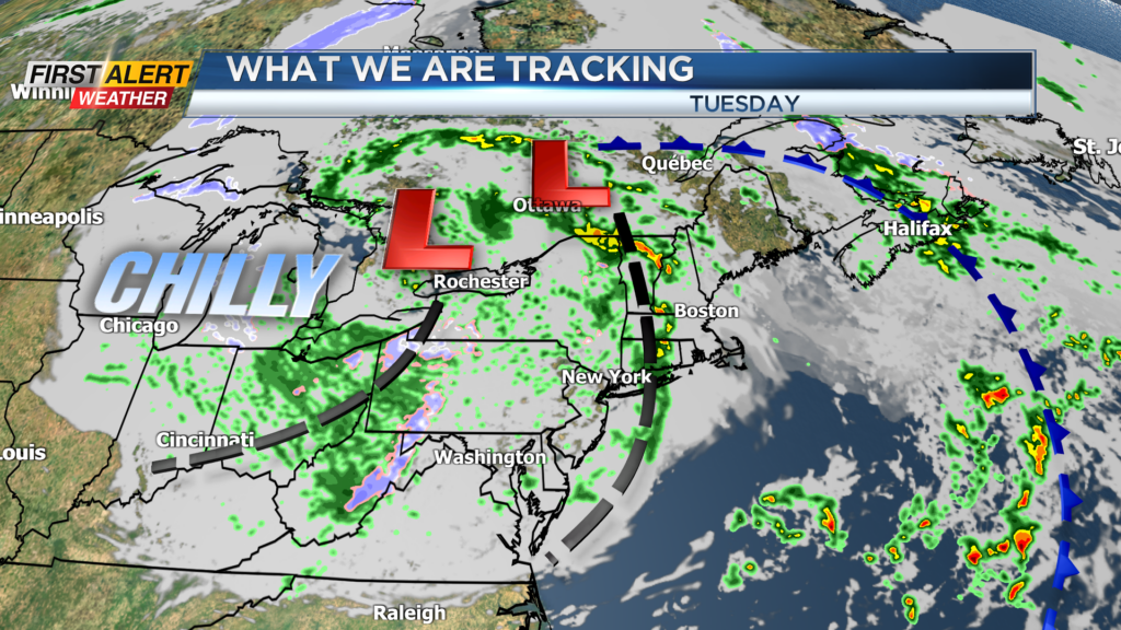
Tonight, look for the steady rain, especially east of Rochester, to slowly taper to scattered showers overnight. The low temperature will be near 42 degrees by morning. Monday skies may brighten early, but more occasional rain showers will return with maybe some thunder for the Finger Lakes. The mercury will rise into the lower 50s. Tuesday will bring more showers and with colder weather there is the chance of some pockets of graupel or ice pellets. The greatest likelihood for this would be in the higher elevations south of Rochester. The high temperature will only be in the upper 40s. The chance of rain will begin to drop Wednesday and Thursday, but lingering rain showers will be likely. Then finally some drier weather will arrive with more sunshine for next weekend.
Stay turned to News 10NBC First Alert weather for updates on the forecast.