First Alert Forecast: Tracking wintry mix today, then yellow alert for Friday
[anvplayer video=”5164922″ station=”998131″]
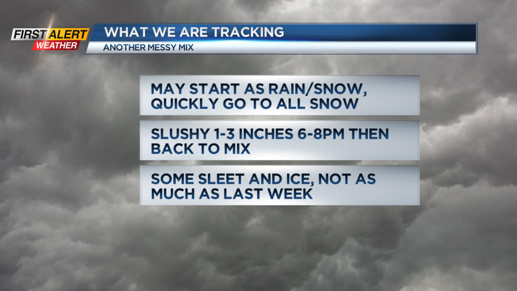
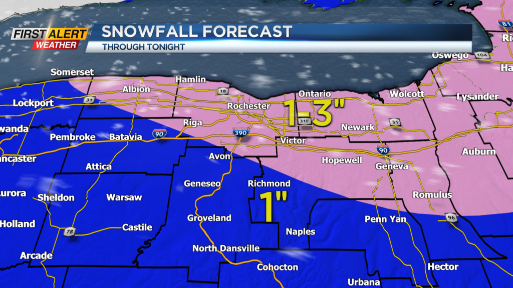
ROCHESTER, N.Y. – Cold and clear this morning so watch your step outside as any melting from yesterday will be icy now. Quiet weather through early afternoon with increasing clouds through the day. Tracking our next storm arriving late this afternoon into the evening hours. Precipitation should arrive around 4-5 p.n. and start as a little rain and snow mix. Any mix will change to all snow for a few hours this evening and bring 1-3″ on average. Not a lot of snow, but just enough to cover the roads and bring slick travel for a bit tonight. After 9-10 p.m. slightly milder air moves in and we see a change to snow and sleet and a little freezing rain. This will keep the slick travel going into the overnight, but thankfully the amounts of sleet and ice will be much less than what we saw last week.
A little mix of rain and snow will still be around early Tuesday morning, then we dry out with a gusty wind developing tomorrow. Milder on Wednesday and then another storm threatens later Friday into Saturday.
There is the potential for significant snowfall heading into the start of weekend. As a result of this second storm, the News10NBC First Alert meteorologists have issued a yellow alert for Friday and Friday night.
Stay tuned to News 10NBC First Alert for updates on the forecast.