First Alert Forecast: Tropical storm comes ashore in North Carolina
[anvplayer video=”5193286″ station=”998131″]
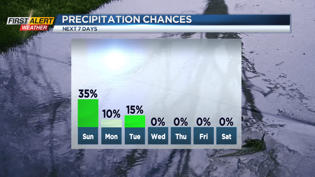
ROCHESTER, N.Y. – Tropical Storm Ophelia continues to move inland along the mid-Atlantic coast on Saturday. There have been many reports of coastal flooding, strong winds and localized heavy rain for that area. However, Western New York is located along the northern fringe of this storm, so most of the impact will be felt well south and east of Rochester. Some light sporadic rain will be located across portions of the Finger Lakes during the next 24 hours and most of the immediate Rochester area should remain nearly dry for the remainder of the weekend. Then, by the end of the weekend, high pressure will move back across the great lakes providing an extended period of clear and dry weather through the end of the month.
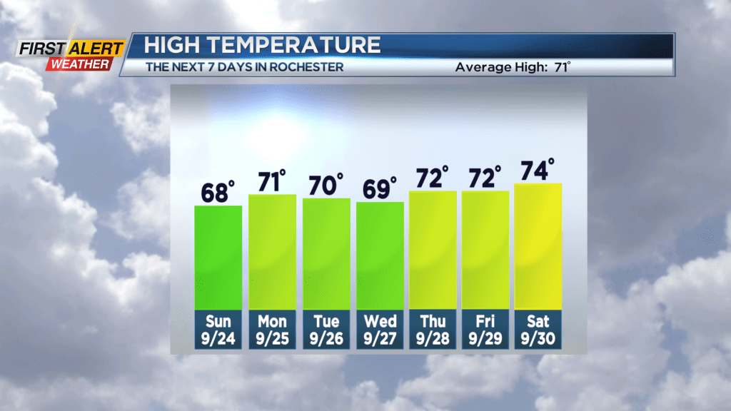
Saturday night look for mostly cloudy skies. There is the chance of a few sprinkles or a shower mainly south and east of Rochester. The low temperature will be in the low to mid-50s. Sunday will bring more clouds with the chance of a shower, but again the best chance of wet weather will be south and east of Rochester. The high temperature will be in the upper 60s.
The last week of September looks to be largely uneventful. Monday through Saturday will feature mainly clear skies with little or no chance of rain. It will feature cool nights with readings near 50 degrees and mild afternoons with the temperature rising to near 70 degrees.
Stay tuned to News 10NBC First Alert Weather for any updates on the forecast.