Weather Update: A rainfall record Monday, now a few dry days for us
[anvplayer video=”5130785″ station=”998131″]
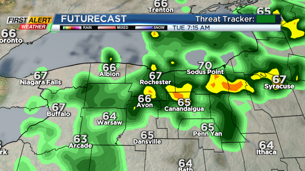
ROCHESTER, N.Y. – Monday’s rainfall at the Rochester airport set a daily record for that date, recording 1.09″ of what many now consider liquid gold! We’re taking a little break from the rain, as high pressure builds in tonight, bringing us a clearing sky and a good deal of sun for the middle of the week. Both Wednesday and Thursday will see a partly to mostly sunny sky, and seasonable temperatures in the lower 80s. A cold front will drop in on Friday, bringing in another round of scattered showers and some thunder.
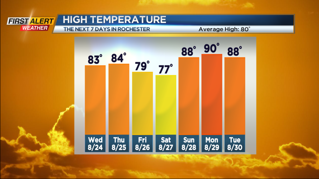
High pressure returns for the weekend, which means mostly dry weather. Saturday will be the cooler of the weekend days, with highs in the 70s under a mix of clouds and sun and low humidity. Sunday turns warmer and more humid once again, as temperatures climb back through the 80s and dew points into the 60s. Outside of a slight chance for a shower Sunday afternoon, the weekend will be dry. Monday should be our best shot at 90 degrees, before a cold front on Tuesday brings another round of showers and thunderstorms to the region, holding temperatures back a bit.
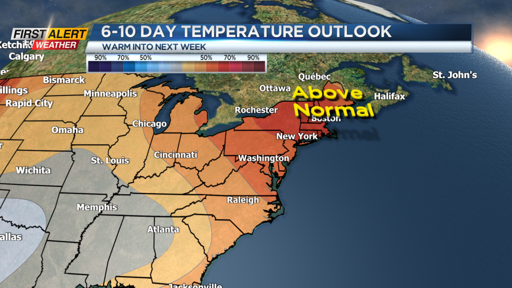
So, the next week should be fairly warm, but there are some signs that we’ll swing the other way by the end of next week, with highs dropping to below-average readings, keeping daily high temperatures in the mid-70s.