Weekend update: Some sun to start, some snow to end
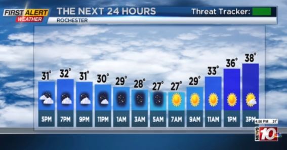
Sunshine was hard to come by this week, but that should change on Saturday. We’ll see a slowly clearing sky Friday night, setting the stage for a brighter sky on Saturday, despite a fast moving system diving to our south. We’re still expecting a fairly weak system moving in on Sunday to deliver a mix of rain and some wet snow. Any snow accumulation should be confined to grassy surfaces, and less than 1″ for most. The exception will be the higher terrain of the Finger Lakes and Southern Tier, where 1-3″ is possible there. Flurries will end early Monday, leaving us with quiet and dry weather through Wednesday.
Then our attention turns to our next potential winter system. This is still about 5-6 days away, and the energy hasn’t even moved ashore in the Pacific Northwest yet, so confidence remains low as to what impacts this may have on us. But, we’re tracking the chance for a wintry mix of ice and snow moving in Thursday, with snow taking over. Snow would begin to taper on Friday, followed by a blast of chillier air and perhaps some lake effect. Some big questions remain, though, which will have a major influence on what kind of impact we may see late next week. We should begin to see some of these questions become a little more clear this weekend.
If current trends continue, a Yellow Alert will be needed for next week.
We’ll keep you updated.