First Alert Forecast: Winter not expected for most of the week
[anvplayer video=”5162199″ station=”998131″]
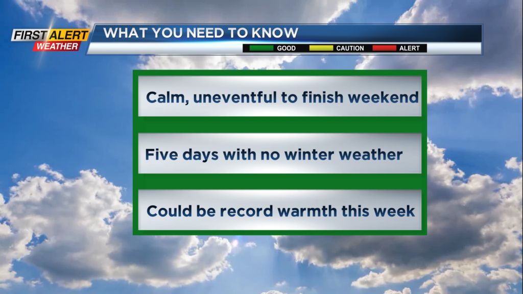
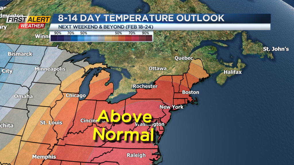
ROCHESTER, N.Y.- A sprawling high-pressure system is extending from New England, the Great Lakes and into the Ohio Valley which will provide an extended period of uncommonly pleasant winter weather. It appears there will be another five days of calm and mainly dry conditions for Western New York. At this point in the season, Rochester is running almost four feet below normal for snowfall and there is little chance this snow deficit will be made-up in the near future.
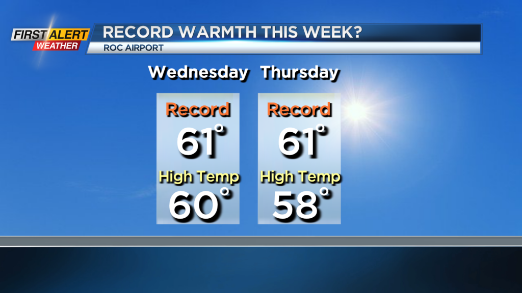
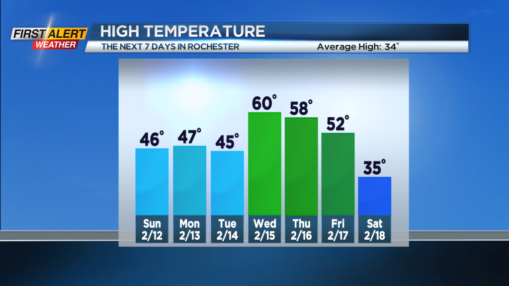
Tonight, look for mainly clear or fair skies for the balance of the night. The low temperature will be in the upper 20s. Sunday, Monday, and Tuesday will bring a fair amount of sunshine. Very pleasant weather for February with the temperature rising into the middle 40s for each day. Wednesday and Thursday we could challenge the record high temperatures for each day. The record is 61 degrees (1949) for Wednesday and 61 degrees (1921) for Thursday.
Later Friday and Saturday it will be back to reality with much colder weather arriving for the beginning of the weekend.
Stay tuned to News 10NBC First Alert for updates on the forecast.