Yellow Alert: Damaging winds possible Tuesday
ROCHESTER, N.Y. – We’re tracking a strong storm moving through the Great Lakes that will bring some wet snow, rain, and winds to our area.
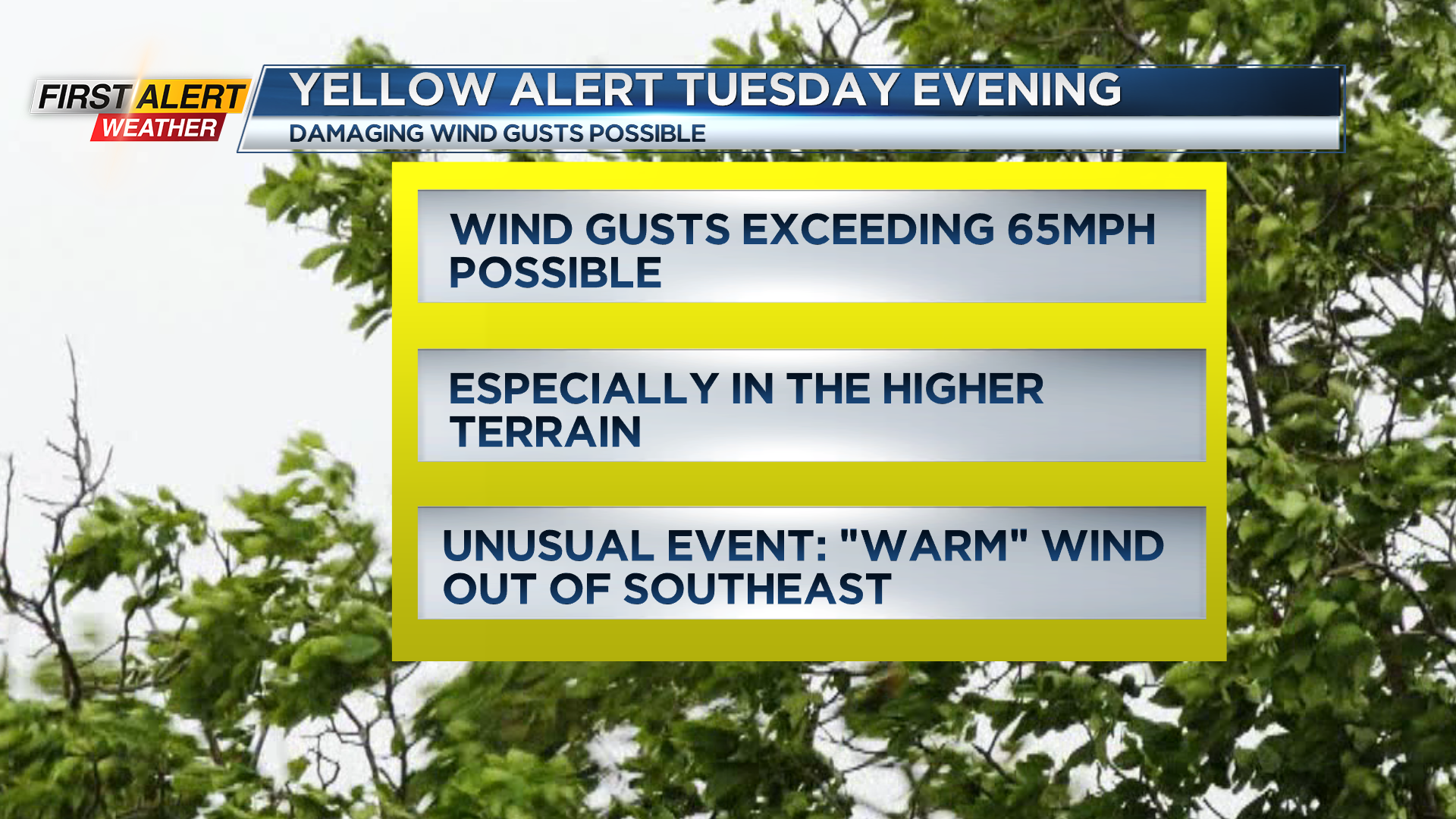
Our biggest weather impact will be the potential for damaging wind gusts on Tuesday. The morning starts off just breezy with some rain mixing with wet snow. Little to no accumulation is expected. Mix changes over to snow as temperatures climb into the 40s, thanks to a strong southeasterly wind.
We’ll have very strong wind just a few thousand miles above the ground, and the concern is that some of that wind may make it down to the surface. If it does, we will likely see some tree damage and power outages.
The parts of our area that have the greatest potential of wind gusts exceeding 60 mph are the higher terrain, the hilltops of the Finger Lakes south of Rochester. Another unusual part of this event is the wind direction.
Our strongest winds will come from the southeast. Our trees are used to a prevailing wind out of the west, so the roots grow stronger.
A southeasterly wind will tap into a weaker root structure, and may be more prone to uprooting. Confidence is highest in the strongest gusts south, with confidence for damaging winds lower near Rochester. We may also have a line of gusty winds as our cold front comes through just before midnight. If some of these strongest gusts do become more probable, we may upgrade to a Red Alert.
Stay with the First Alert Weather Team for updates.
Wednesday will be chillier with snow showers and still windy, but we don’t expect damaging winds. Thursday will be fairly quiet, before another system moving in brings some snow late on Friday, followed by some lake effect and much colder air this weekend. This may have an impact on the Buffalo Bills playoff game in Orchard Park on Sunday afternoon.