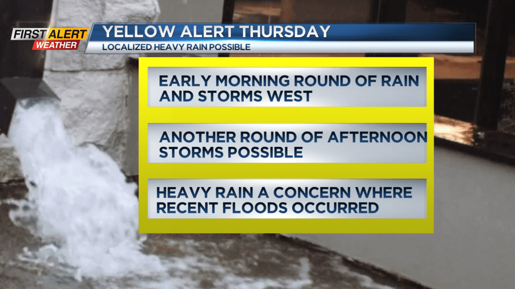
Yellow Alert: Potential for locally heavy rain and a few storms Thursday
[anvplayer video=”5184985″ station=”998131″]
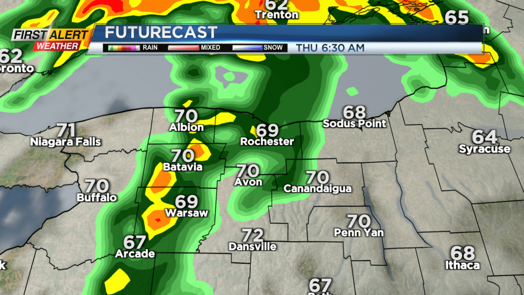
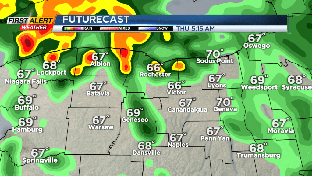
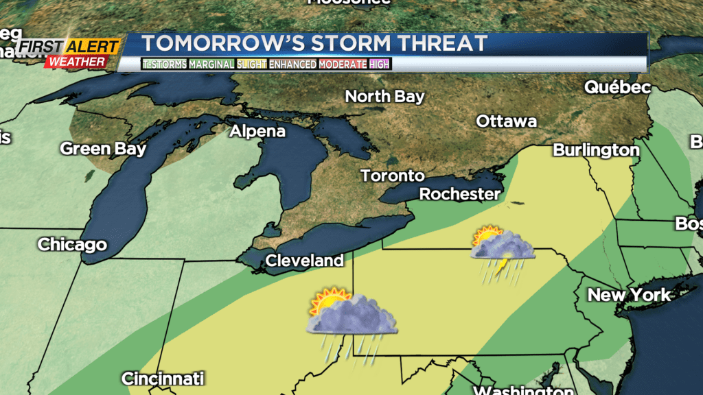
A Yellow Alert is up for Thursday for parts of our viewing area, specifically the Finger Lakes. A Flood Watch is posted for Wayne and Ontario counties. Recent heavy rain and flooding has been a problem in these areas in recent days, and the setup on Thursday may lead to more heavy rain. If it does, we could see some localized flash flooding in these same areas. We have a warm and more humid airmass that’ll be working back into the area on Thursday. Initially, we may see some showers and pockets of thundery downpours overnight and into early Thursday. There’s the slight chance a few of these could produce gusty winds west of Rochester and toward Buffalo.
Then, we see a lull through the morning into the early afternoon. Building instability may lead to another round of scattered showers and some isolated thunderstorms during the afternoon. This is a bit more questionable, but if these do develop, the potential exists for a few of these storms to be strong with gusty winds and locally heavy rain. Given the recent heavy rains, and the possibility of another round with any storms that do develop, we have that Yellow Alert posted. The First Alert Weather team will continue to update this forecast into Thursday.
Friday will see some quieter weather, before another round of humid air and some thundery downpours moves in over the weekend. The weekend isn’t a washout at this point, but plans will likely need to be made around some potentially stormy weather at times.