Yellow Alert Saturday for strong winds, plus developing lake effect snow
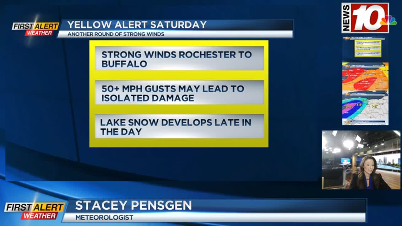
Our weekend will turn very wintry, very quickly this weekend. A potent storm system moving through the Great Lakes will change snow over to rain tonight as temperatures initially rise. We’ll have a brief round of gusty winds, mainly in the Finger Lakes tonight. As the low pulls away Saturday morning, temperatures will begin to drop, and winds begin to pick up again out of the southwest. While not as widespread or intense as our last round of wind, we could potentially see some isolated damage and power outages, especially west of Rochester. The corridor from Rochester to Buffalo could see some gusts pushing 50-60 mph, with the gusts getting stronger as you go west. This will be a more prolonged wind event, though, with winds starting to ramp up late morning, and lasting into late in the evening. Winds will still be gusty on Sunday, with some gusts pushing 40 mph, but we don’t expect any outages on Sunday.
As the air grows colder on Saturday, we’ll start to see some lake effect snow developing. It will be scattered and unorganized at first, then organize into a single band over Lake Erie starting Saturday night. The snow will become heavy near Buffalo, and start to impact travel along the Thruway in Erie and Genesee counties Saturday night and on Sunday. Snow will be heavy in the heart of the lake band, and visibility will be greatly reduced. Again, the main band and the worst of the conditions will be in and around Buffalo, but that band will impact parts of Genesee County, Orleans County and possibly western Monroe County on Sunday. The Bills game on Sunday will feature snow at times, temperatures in the lower 20s and upper teens, and a gusty wind that will make it feel more like the single digits.
Stay with the First Alert Weather team on air and online for updates on the wind and lake snow. Meteorologist Alex Bielfeld will have an update on News10NBC Today starting at 6 Saturday morning.