First Alert Weather: Extreme cold and Yellow Alert for Thursday night into Friday
[anvplayer video=”5160589″ station=”998131″]
ROCHESTER, N.Y. – We certainly enjoyed the sunshine Wednesday and we’ll get a little more on Thursday, but big changes arrive after that. Temperatures on Thursday start in the lower 20s and we’ll see a fair amount of sun until late afternoon.
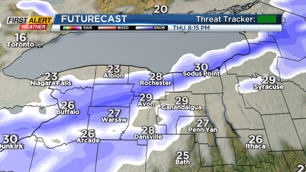
Temperatures will rise into the 30s thanks to a stiff southwesterly wind. While that wind will help to bump us above freezing, it’ll also make it feel chillier as it whips by. Those winds will really crank along and behind an arctic front, which is set to arrive around 7 or 8 Thursday night. This front will come through with a burst of snow and gusty winds. Visibility will drop for a brief period, and we’ll pick up a quick inch of snow.
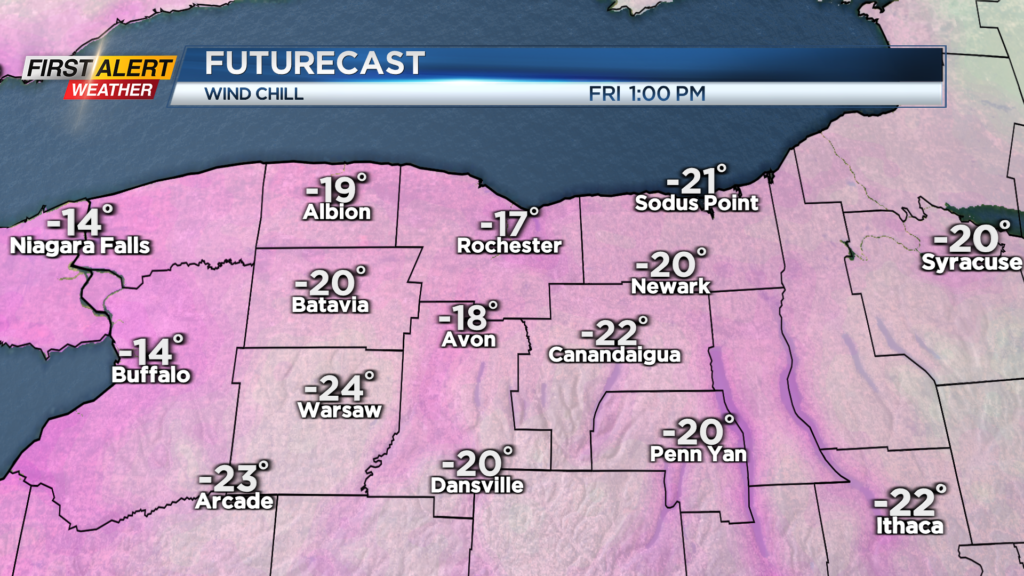
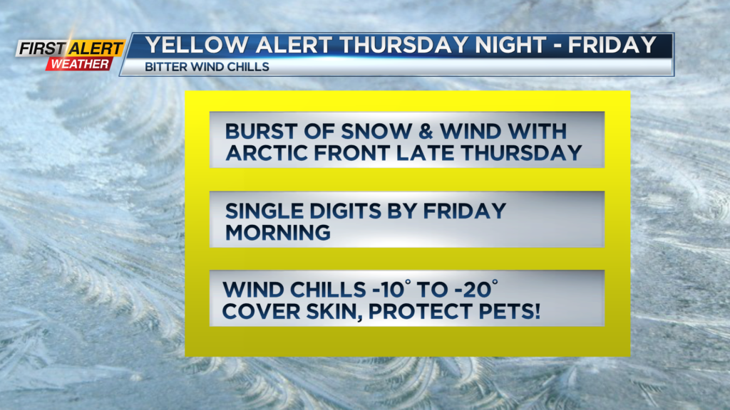
Then the main event arrives: the bitter air. Air temperatures will drop into the lower single digits by Friday morning, and a whipping wind out of the northwest 15-25 mph with gusts to 35 mph will make it feel more like -15° to -20° for much of Friday. This is the kind of cold that you need to protect yourself and your furry friends from. Cover exposed skin when outdoors, and make sure pets aren’t outside too long.
The bitter air lasts into early Saturday morning, with air temperatures likely dropping to or below zero away from Lake Ontario. The good news is that winds will ease, making feel slightly less harsh.
Temperatures rise into the 20s by Saturday afternoon, and keep climbing Saturday night and into Sunday. In fact, we may come close to 40 on Sunday with some sun. The overall trend of next week is for above average temperatures, with the mildest air coming on Tuesday with highs well into the 40s. So, we’ll get this brief shot of winter, then it’s back to the old winter pattern we’ve experienced much of this season.
______________
Download the WHEC First Alert Weather app to stay up to date while on the go.
Watch the latest full forecast online.