First Alert Weather: Snow showers are tapering with little additional accumulation
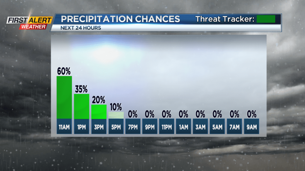
ROCHESTER, N.Y. — The snow showers on Tuesday will dwindle to just flurries for the remainder of the day. As a result, the Yellow Alert has ended.
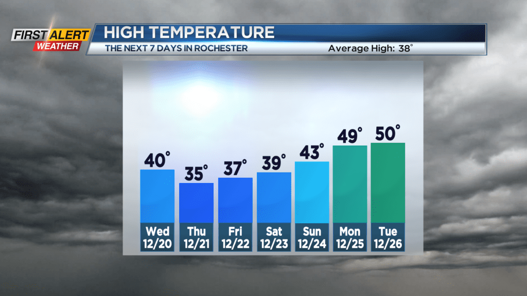
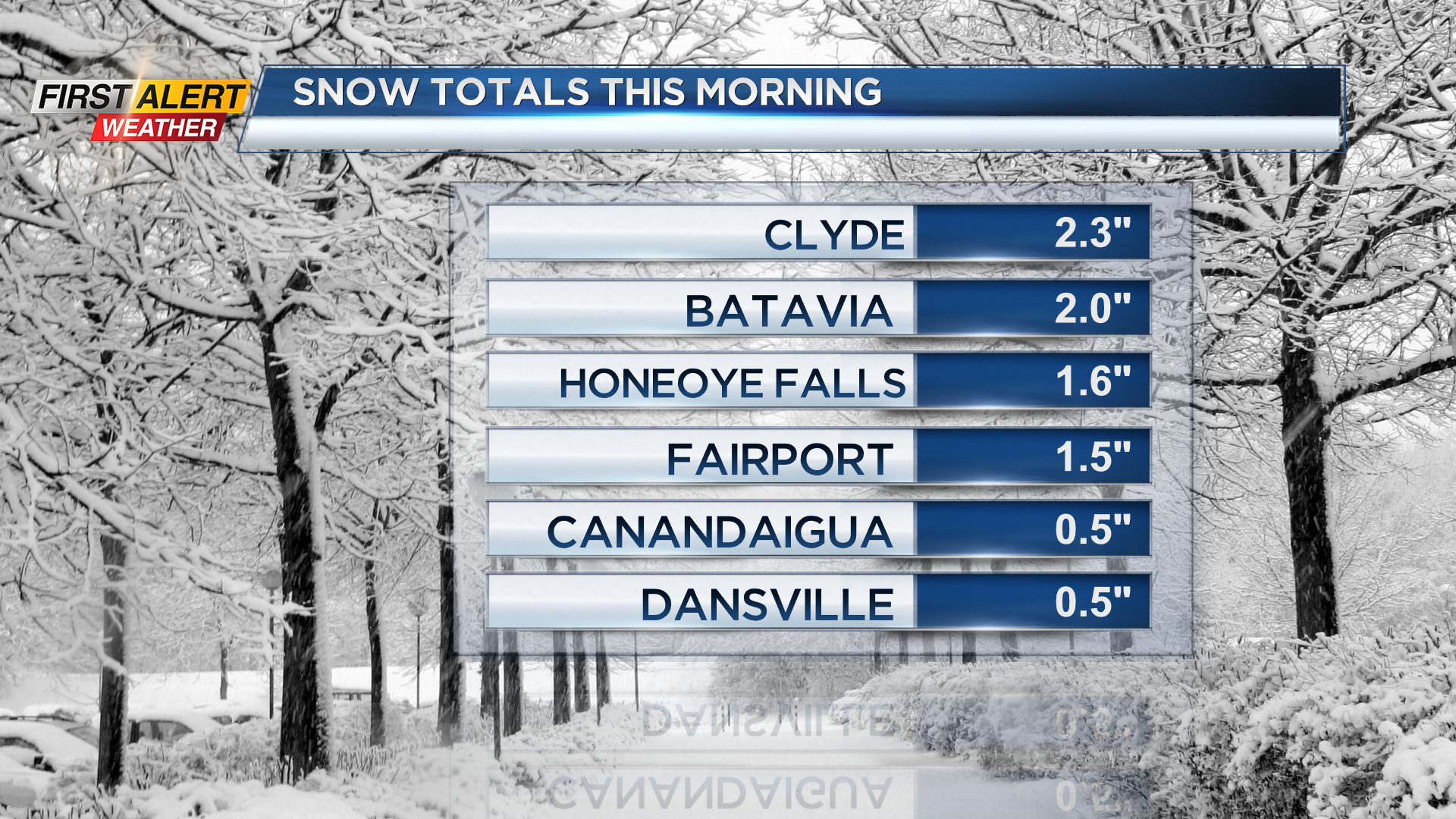
It was a relatively minor snow event for Western New York with snowfall totals running from a half inch to three inches. As a low-pressure system slowly moves away, drier air will move back over the Great Lakes which will bring breaks in the cloud cover with calm weather expect for much of the remainder of the week. Milder temperatures will return in the coming days which will unfortunately melt much of the snow cover as we head into the Christmas holiday.
Look for snow showers to taper into flurries with little or no additional accumulation expected. The temperature will only rise to near 30 degrees. On Tuesday night, will become partly cloudy and continued cold. The low temperature will be in the low to middle 20s.
One Wednesday, you can expect partial sunshine and not as cold. The high temperature will be near 40 degrees. The winter solstice, better know as the start of the winter season, arrives on Thursday. However, it will be an uneventful day with a mix of clouds and sunshine. The temperatures will rise into the middle 30s.
Stay tuned to News 10NBC First Alert Weather for updates on the forecast.