Yellow Alert: Strong winds and plunging temperatures Wednesday
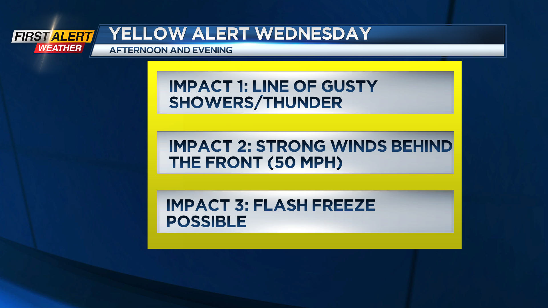
ROCHESTER, N.Y. – Wednesday is going to be a wild ride, with near record warmth, followed by a sharp cold front with gusty winds, a drastic drop in temperatures, strong winds following the cold front, and some snow by evening. The main weather impact will be the gusty winds, which could push 50-55 mph for a few hours during the afternoon and early evening. This likely isn’t enough for widespread damage, but could produce some isolated damage and power outages. Now, before that happens, we’ll feel another day more like May, with temperatures in the lower and mid 60s. The record high for Wednesday’s date is 64, so it’ll be close before the cold front plows through. We also need to watch out for the potential for a flash freeze around the evening commute as we may see the rain freeze quickly on any untreated surfaces. We’ll also see some lake snow developing overnight and into Thursday morning, but that shouldn’t be a major problem, and our Yellow Alert should be allowed to expire by Thursday morning.
We’ll have one chilly day with highs in the lower 30s and upper 20s with lake flakes on Thursday, but we’re already tracking our next big warm up. We’re back in the 50s on Friday and Saturday, 60s on Sunday, and near record warmth Monday and Tuesday of next week.