Yellow Alert Weather for Saturday: Strong winds and local lake effect snow
ROCHESTER, N.Y. — It has been mostly quiet weather on Friday but things are expected to get a little rowdier as we head into Friday night and Saturday.
A Yellow Alert is still in effect on Saturday for strong, gusty winds. Winds have been breezy and blustery so far on Friday but they will pick up tonight.
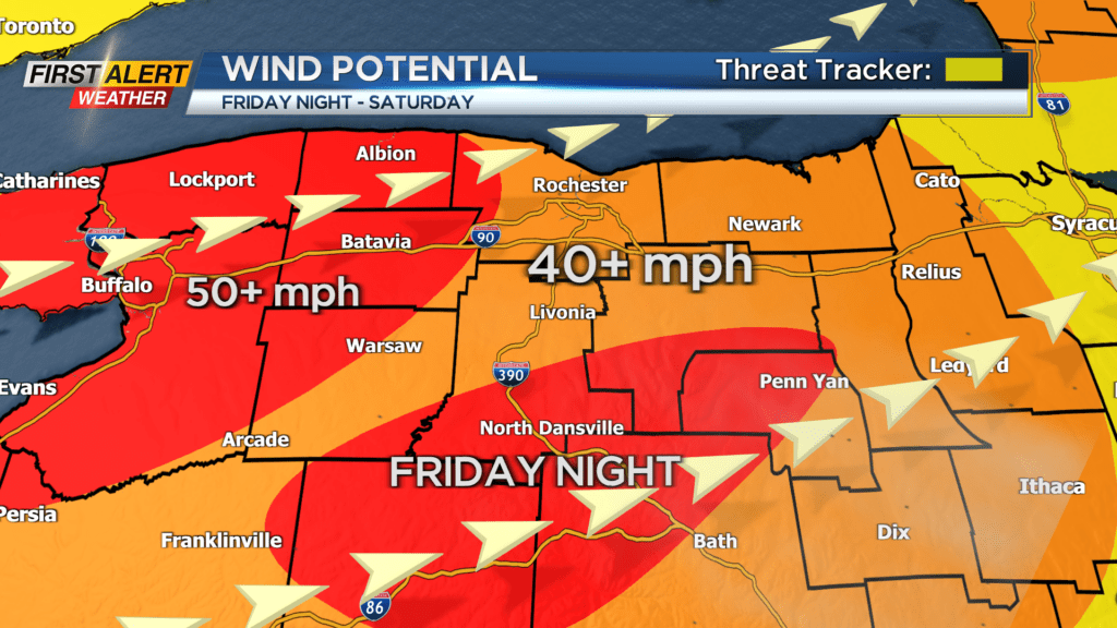
As our cold front approaches after midnight on Friday, we will see gusts pick up and gust near 50 miles per hour or more as it passes by. The strongest of the gusts will be for the Finger Lakes region on Friday night as the winds come out of the southeast.
Once the front passes by, the wind direction will switch from the southeast to the west/southwest direction and switch the strongest of the gust from the Finger Lakes to areas Rochester westward. Winds through the day on Saturday will be gusty with gusts anywhere between 40 and 50 miles per hour, along with an occasional gust near 60 miles per hour.
Power outages will be possible through the next 24-36 hours due to the strong winds. High Wind Warnings will go into effect this evening for our entire region with the exceptions of Seneca and Yates Counties as they are under Wind Advisories.
Another factor with the wind will be the wind chill. Temperatures will start off near 40 on Saturday before dropping to near 30 in the afternoon. With the gusty conditions we will be tracking wind chills in the low 20s and teens through the afternoon.
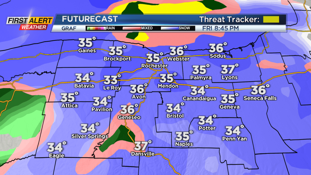
Along with the winds will come some precipitation. The evening commute Friday will be just fine, but around 8 this evening is when snow rolls in. Snow will be a bit heavy at times early tonight before changing over to rain. No major issues are expected, but a slick spot or two will be possible early.
Temperatures warm up to near 40 by midnight and we completely change over to rain by then. Rain showers will remain in the forecast until the cold front passes by late tonight and injects the colder air.
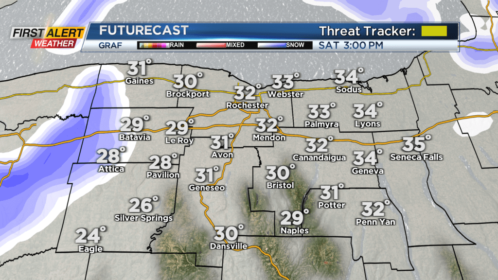
Rain and snow showers early Saturday morning go back over to snow Saturday afternoon with temperatures dropping. No snow accumulation is expected locally by the end of the day on Saturday, but minor accumulations in the higher elevations are possible.
Then Saturday night, our focus will begin to switch from the winds to bitter cold and lake effect snow which will set up off Lake Erie by Sunday morning.