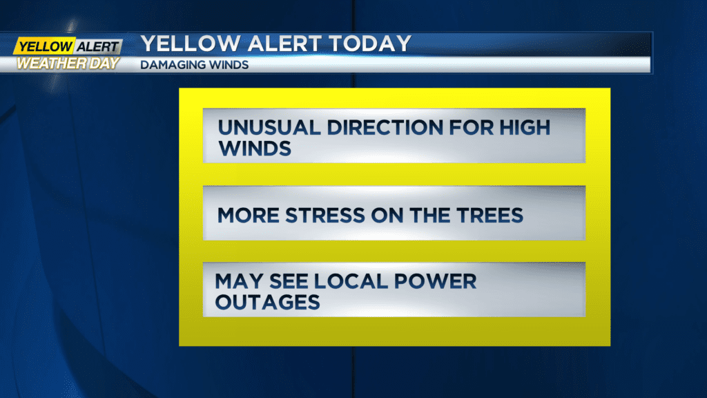
Yellow Alert Weather: Potentially damaging wind gusts later into Tuesday
ROCHESTER, N.Y. — We’re tracking a large and strengthening storm system in the middle of the nation that will bring a brief mix and then a steady rain on Tuesday afternoon into the night.
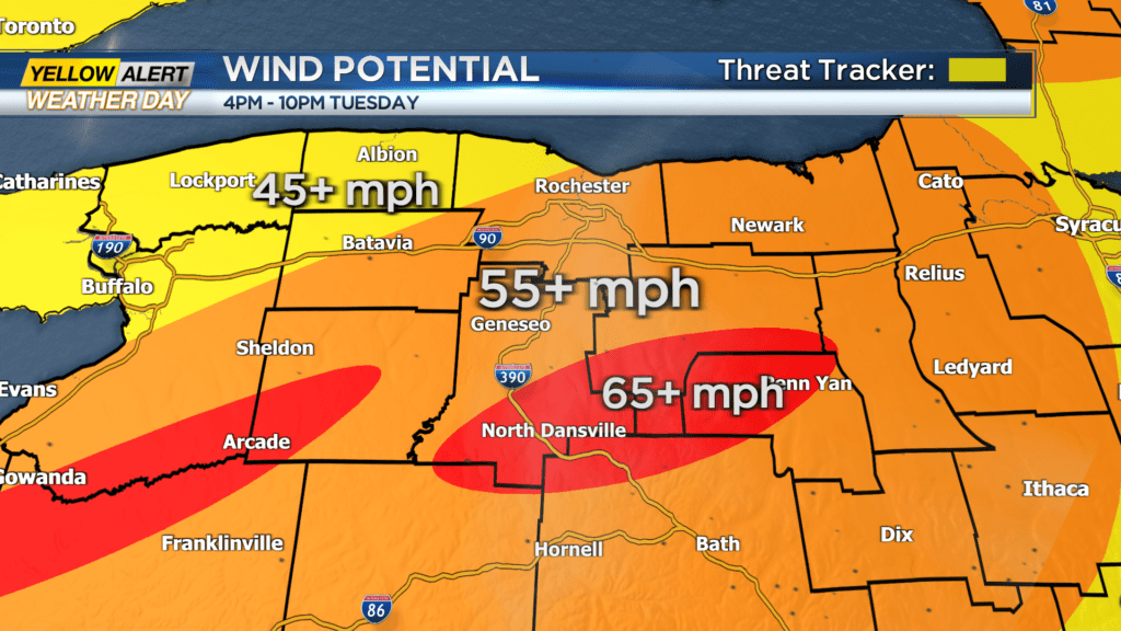
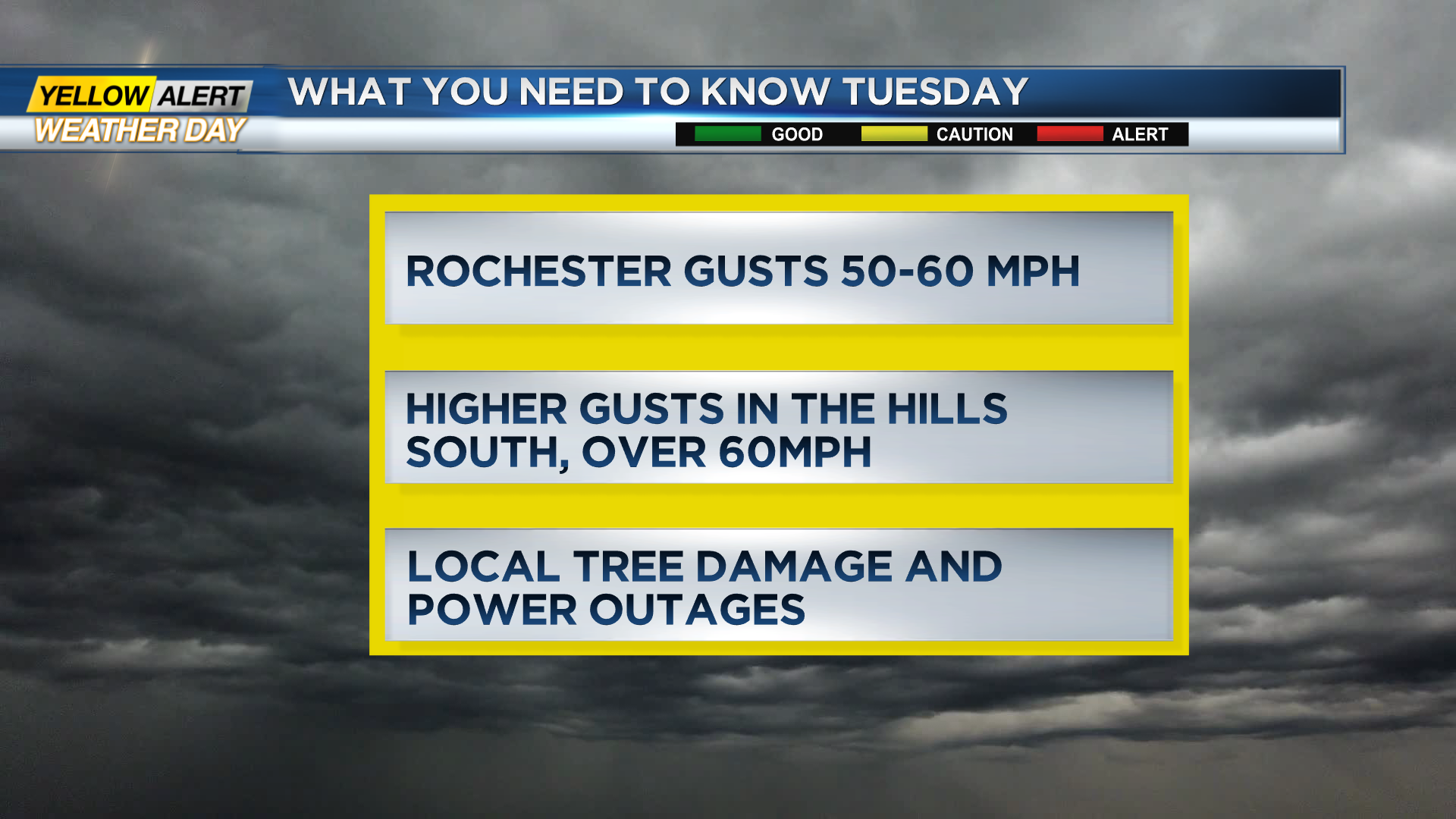
As the storm gets closer to Rochester, we will see a noticeable increase in wind in the afternoon into the evening. The Rochester metro is looking at gusts in the 50-60mph range with some gusts over 60mph in the hills south of the metro.
Winds this strong will cause tree damage and local power outages. At this time it still appears the strongest gusts will happen over the higher elevations across the Finger Lakes and Wyoming County.
The southeast wind direction is unusual for a high wind event in Western New York. This may add more stress to trees that are used to stronger winds from the west and therefore cause more branches to come down than is typical for winds at these levels.
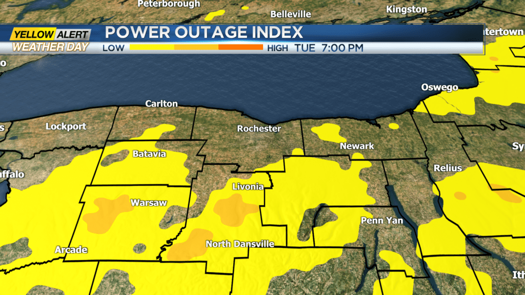
The power outage index is highlighting that threat for areas south of Rochester. This will be a developing weather story Tuesday afternoon into the night. Stay tuned to News10NBC for live updates at noon and then 4 p.m.
If you have photos of videos of the storm that you’d like to see on-air on online, email them to webmaster@whec.com.